

The hydrologic data collection program of the St. Johns River Water Management District collects, processes, manages and disseminates hydrologic and meteorological data that are used for consumptive use permitting, water shortage management, establishment of minimum flows and levels, water supply planning and management, environmental protection and restoration projects, and operation of district flood control facilities. The program is staffed and managed by the Bureau of Water Resource Information.
The bureau operates and maintains 1,600 monitoring stations throughout the district and processes data from approximately 200 additional sites collected by federal agencies, other districts and local governments, or by the U.S. Geological Survey under contract to the district. More than 14 million measurements are collected, verified, processed and stored each year. These data are disseminated to district staff and are made available on this page.

Disclaimer
Data is retrieved from several sources, including but not limited to, federal, state, county and municipal agencies and other water management districts. In no event will the district or the contributing agencies be liable for any direct, indirect, incidental, special, consequential or other damages, including loss of profit, arising from the use of these data, even if the district has been advised of the possibility of such damages.
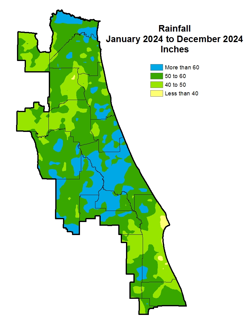
Rainfall figures are defined as follows:
- Daily is the daily mean and is the prior day’s rainfall. (Example: rainfall listed on a Tuesday is the rainfall from Monday.)
- Monthly is a rolling 30-day average through the prior day.
- Annual is a rolling 365-day average.
Rainfall amounts come from the district’s network of rain gauges and may not necessarily reflect rainfall for a specific location.
If you have questions concerning these data, you should contact the Bureau of Water Resource Information at 386-643-1991, the district at 800-451‑7106 or by email at hydrodata@sjrwmd.com.
Controlled water level information for selected areas of the Upper St. Johns River and Upper Ocklawaha River basins is accessible via the links below.
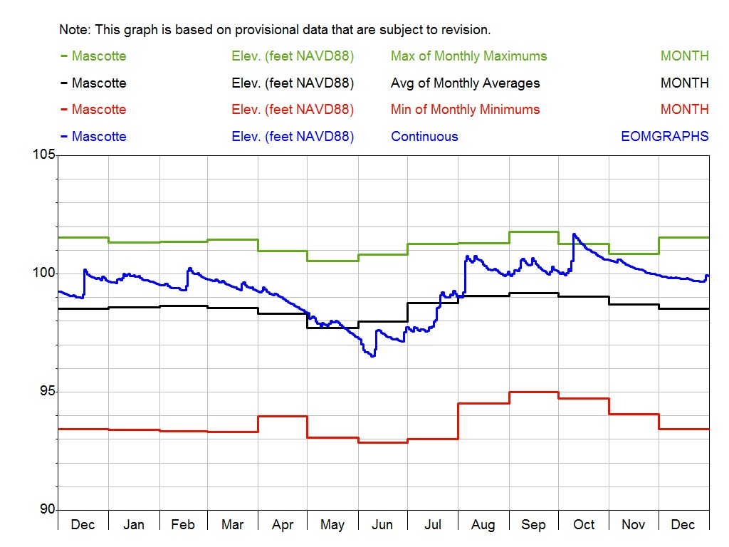
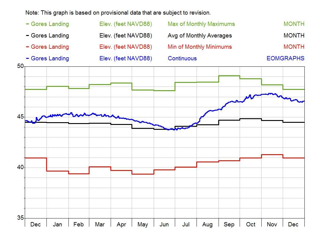
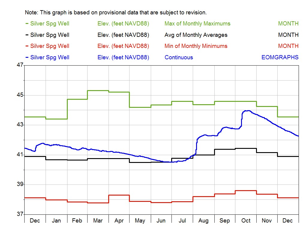
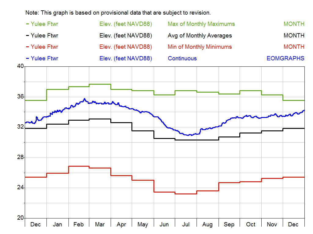
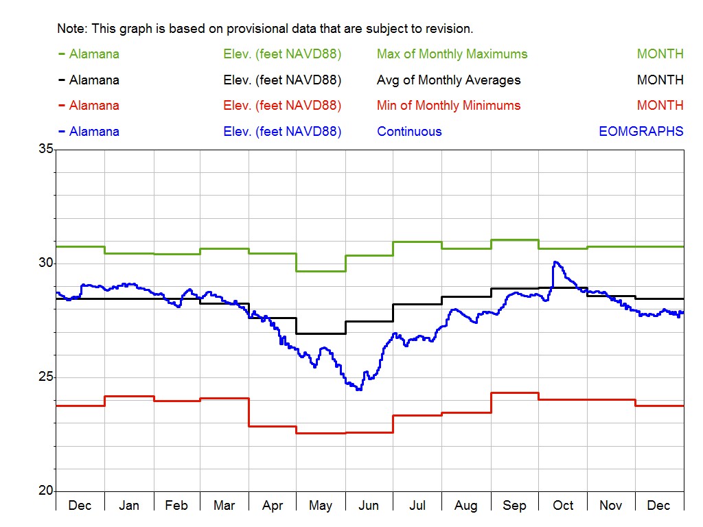
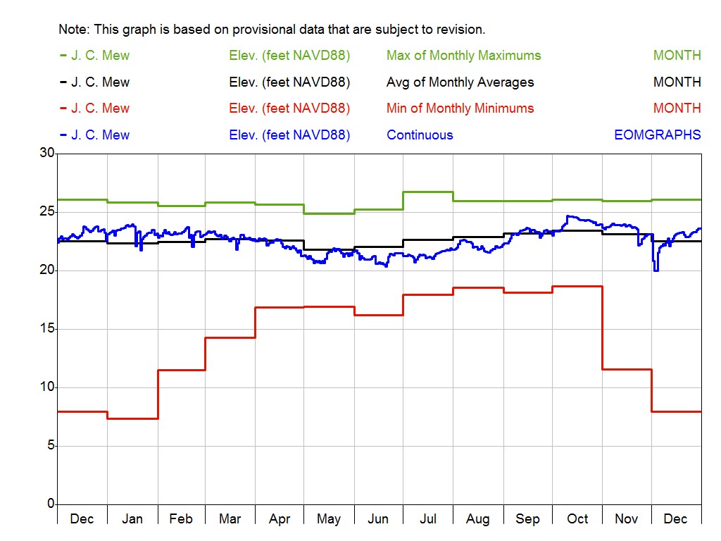
To comply with federal mandates and to ensure consistency with other state and local governments, the district is in the process of converting how it measures and reports elevation data. The former system, known as “mean sea level,” is officially known as the National Geodetic Vertical Datum of 1929 (NGVD 29). The new system is known as the North American Vertical Datum of 1988 (NAVD 88).
| Upper Ocklawaha River Basin |
|---|
| Daily water levels |
| UORB flow system |
| Yearly water levels graphs 1 |
| Yearly water levels graphs 2 |
| Weekly water levels report |
About springs discharge data
The St. Johns River Water Management District develops stage discharge ratings for springs from graphical analysis of current-meter discharge measurements from various monitoring stations on varying schedules and made over a range of stages and discharges. Shifts in measurements can be short- or long-term and can be caused by changes in the streambed, vegetation growth, backwater conditions and other variables. Archived data provided are shift corrected, incorporating the mathematical adjustments for rating. The shift adjustments are applied to the individual ratings as measured data becomes available, resulting in an adjusted rating. Flow data posted as part of the springs stage discharges page is provisional and subject to change.
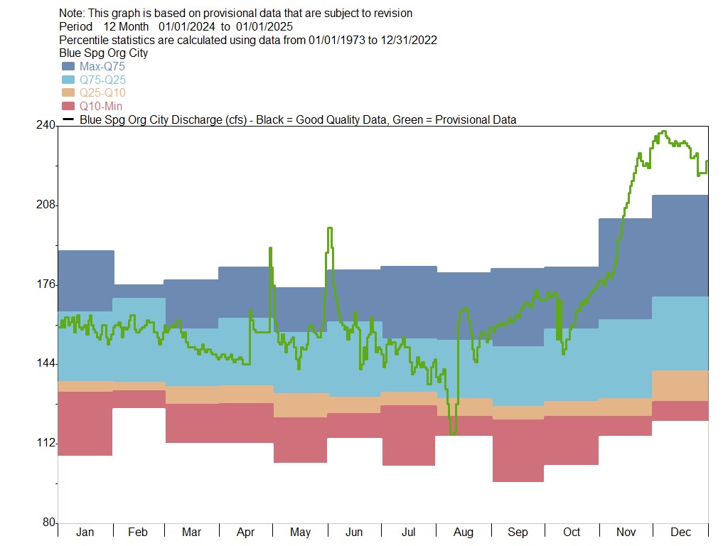
Blue Springs
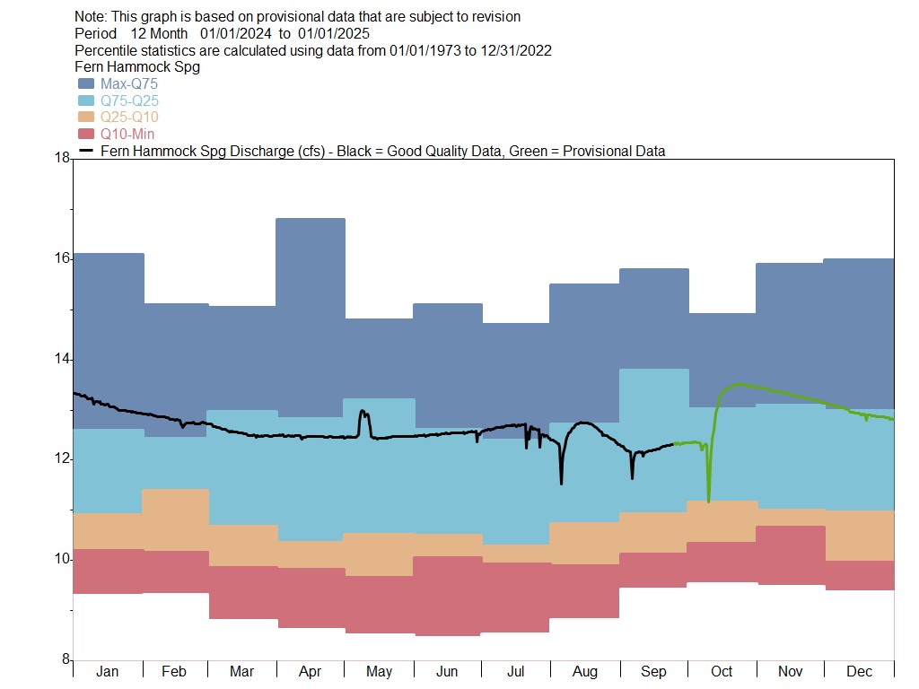
Fern Springs
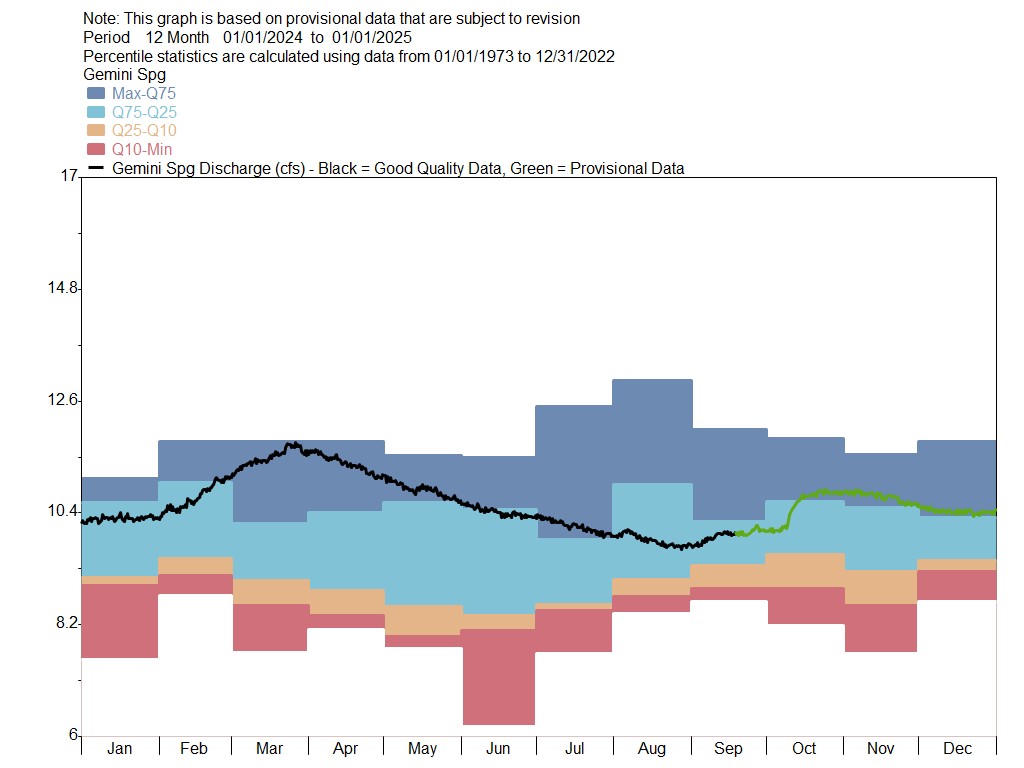
Gemini Springs
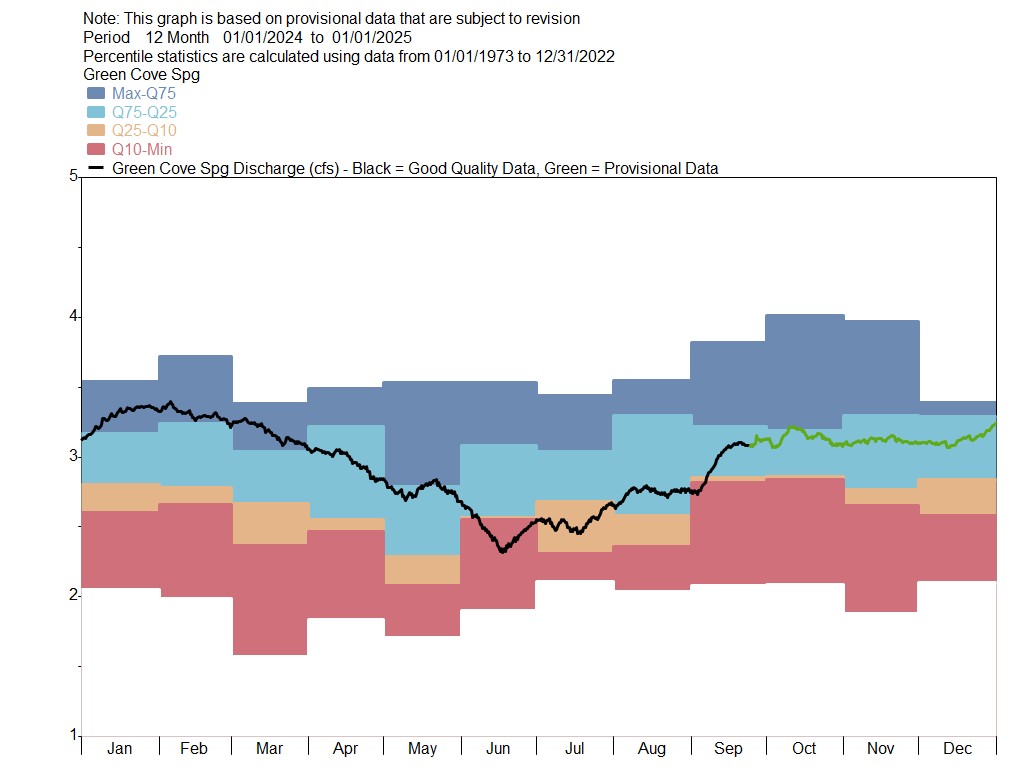
Green Cove Springs
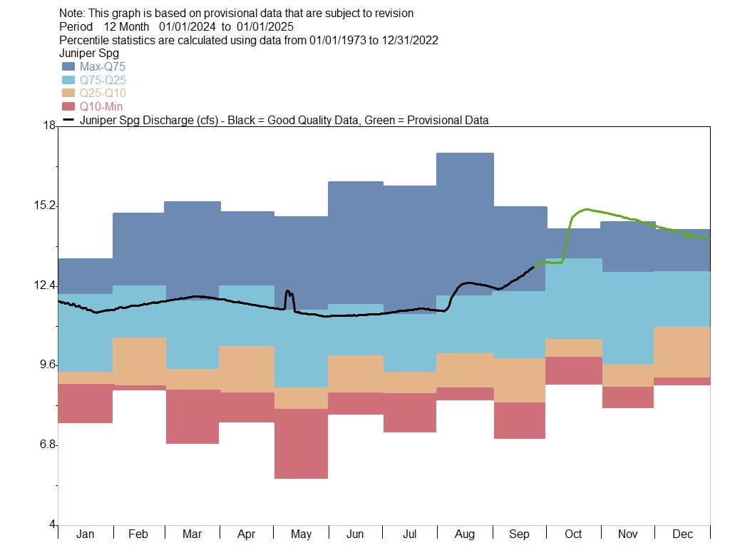
Juniper Springs
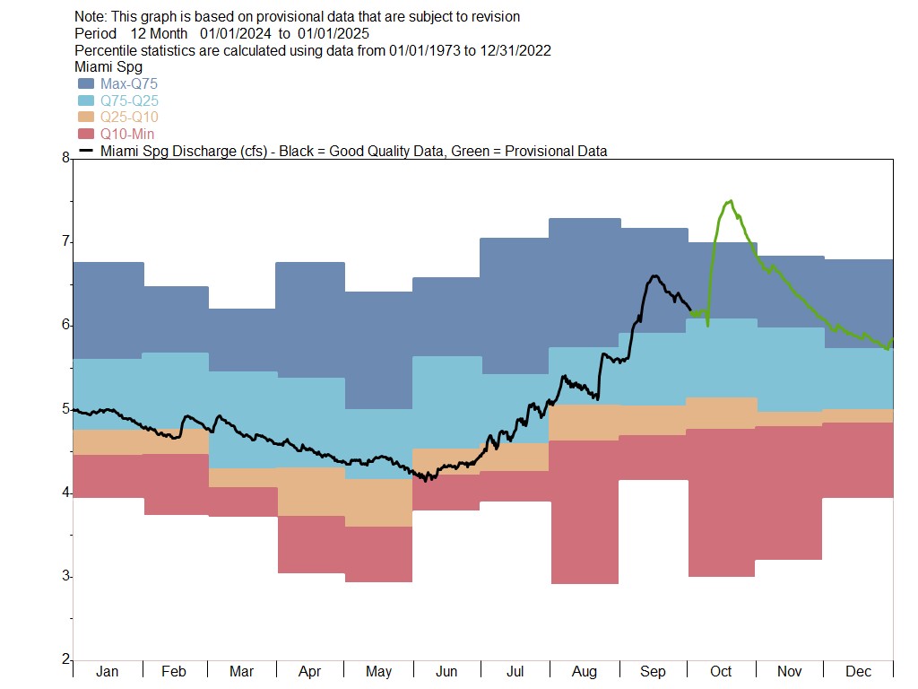
Miami Springs
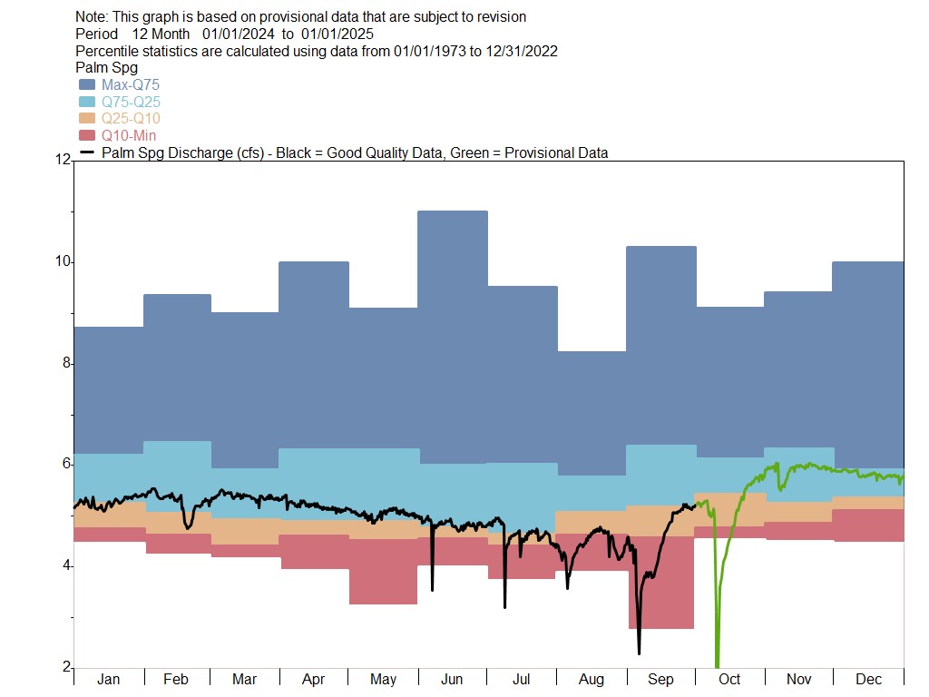
Palm Spring
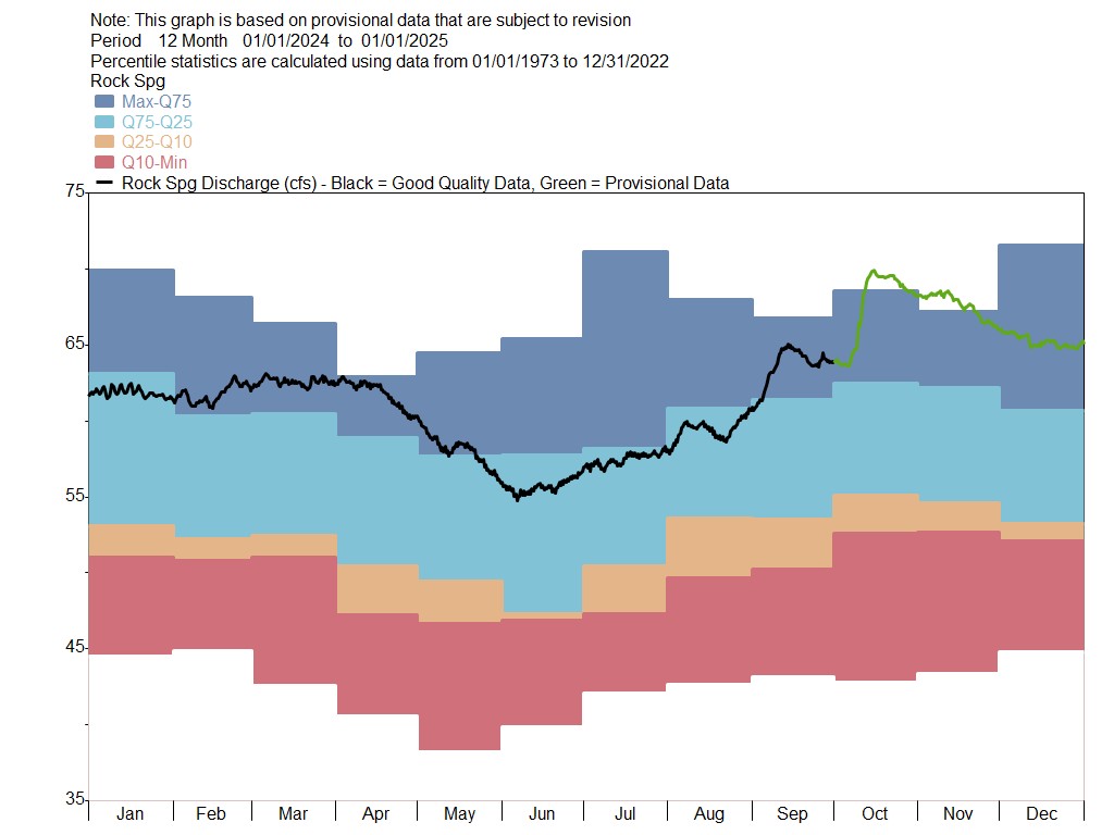
Rock Springs
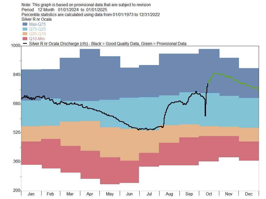
Silver Springs
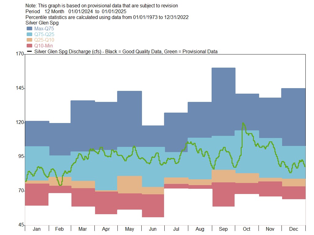
Silver Glen Springs
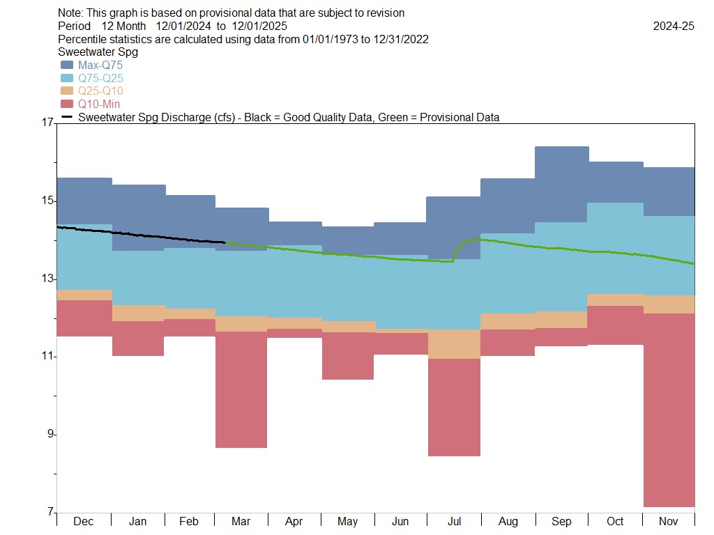
Sweetwater Springs
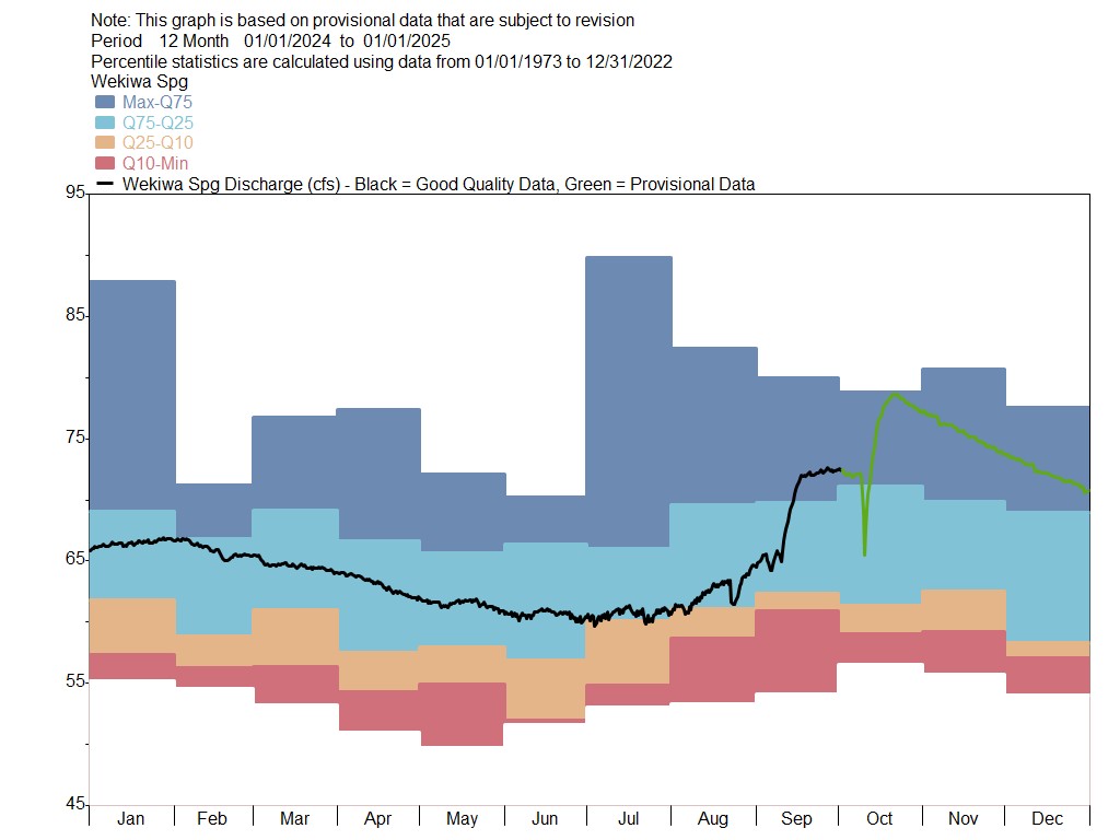
Wekiwa Springs
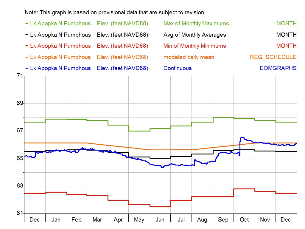
Lake Apopka
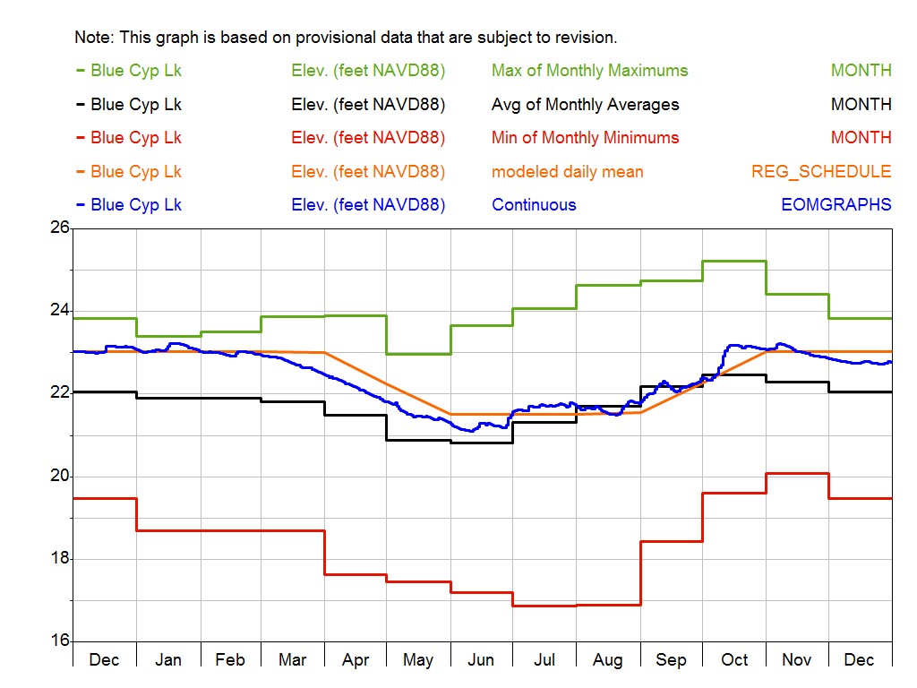
Blue Cypress Lake
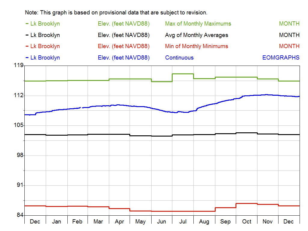
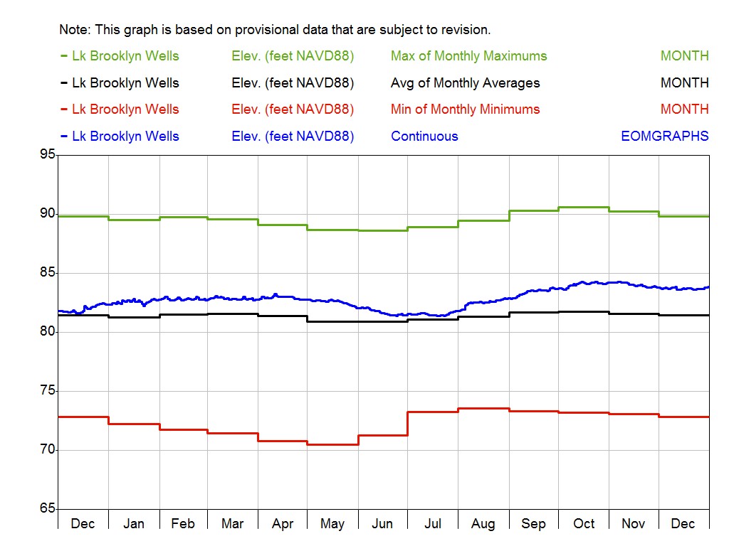
Lake Brooklyn
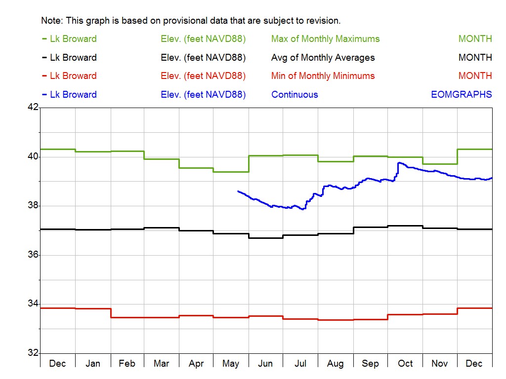
Lake Broward
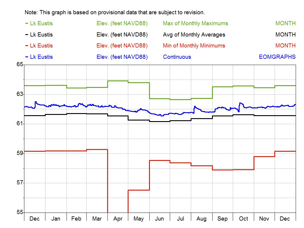
Lake Eustis
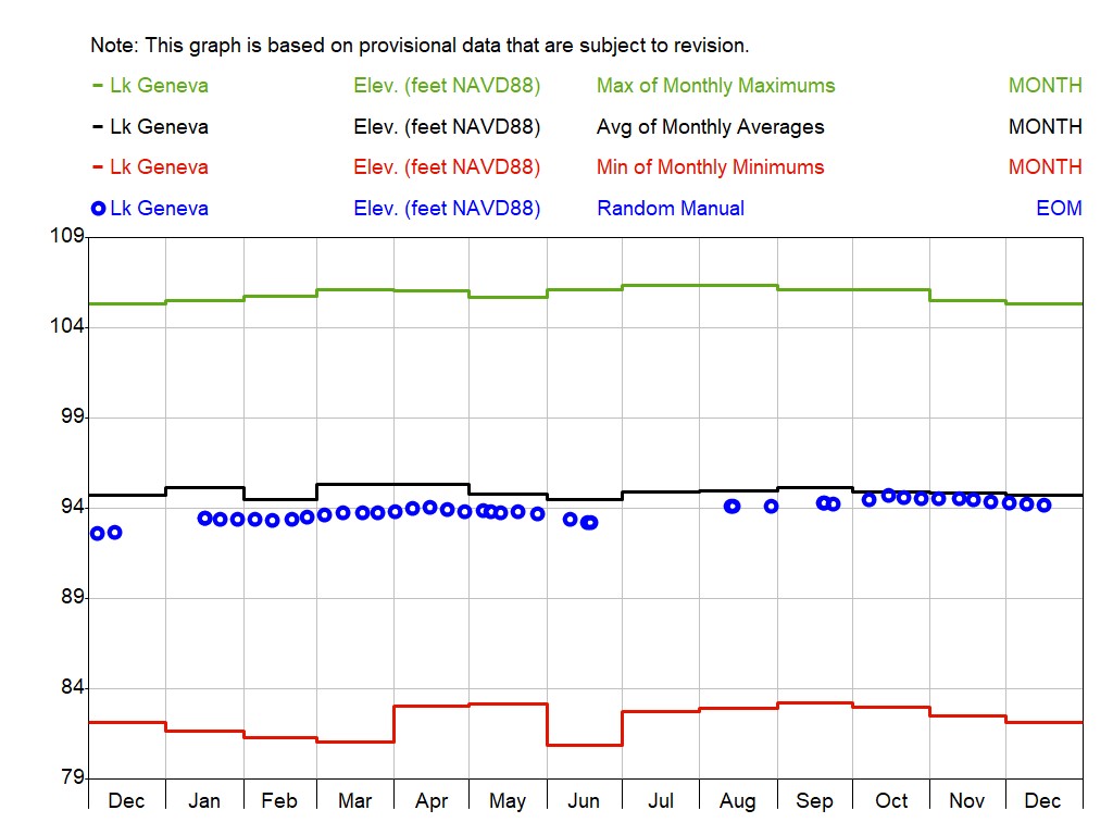
Lake Geneva
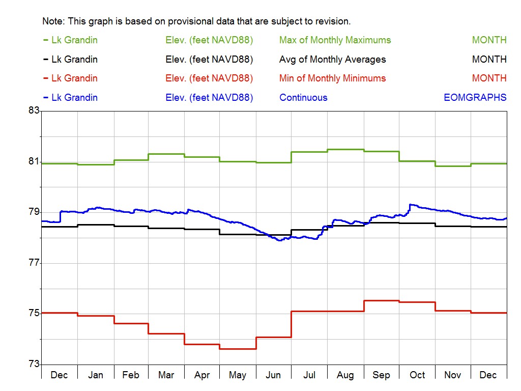
Lake Grandin
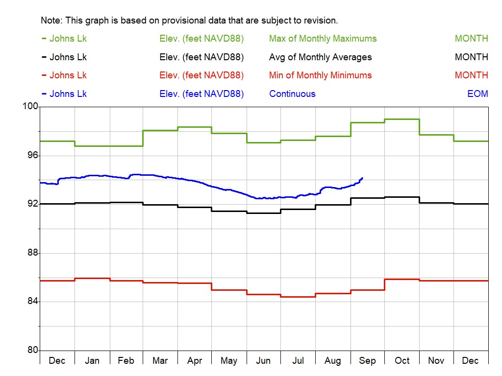
Lake Johns
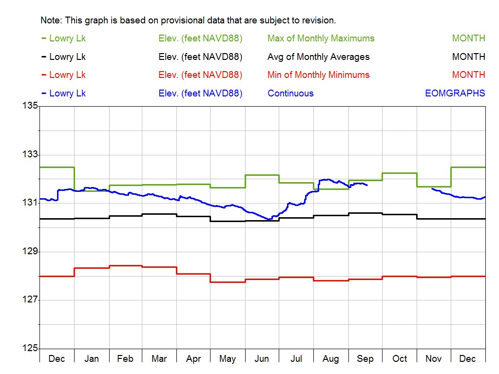
Lowry Lake
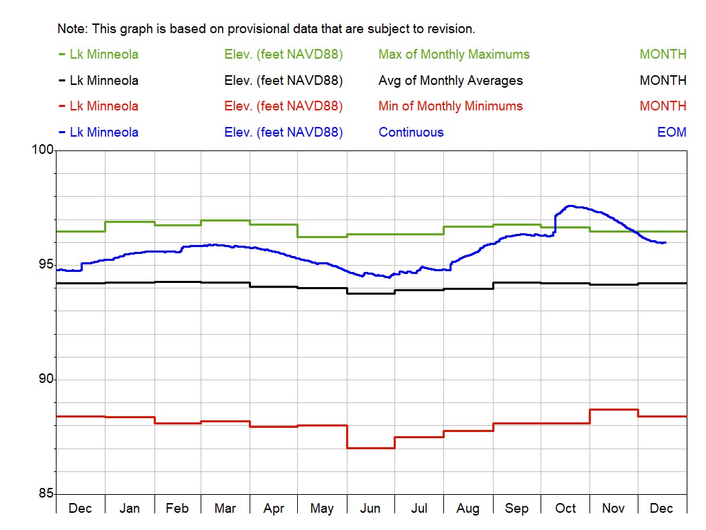
Lake Minneola
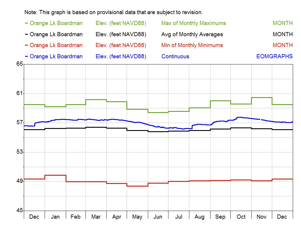
Orange Lake Boardman
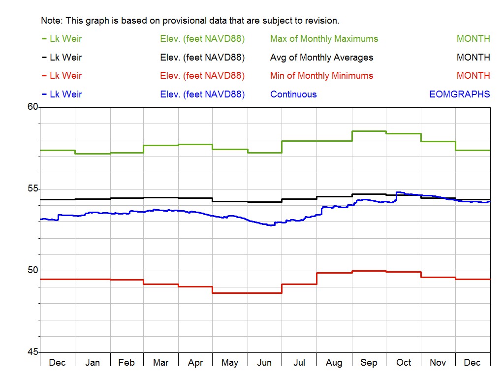
Lake Weir
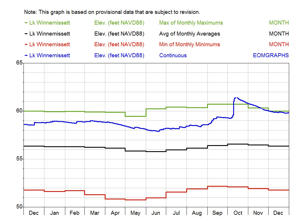
Lake Winnemissett
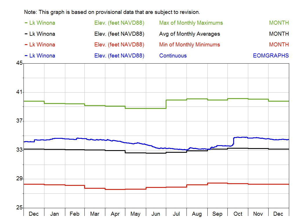
Lake Winona
A-0071
Alachua County
BA0009
Baker County
BA0011
Baker County
BR0001
Brevard County
BR1995
Brevard County
C-0607
Clay County
C-0120
Clay County

D-0667
Duval County
D-0160
Duval County
D-0254
Duval County
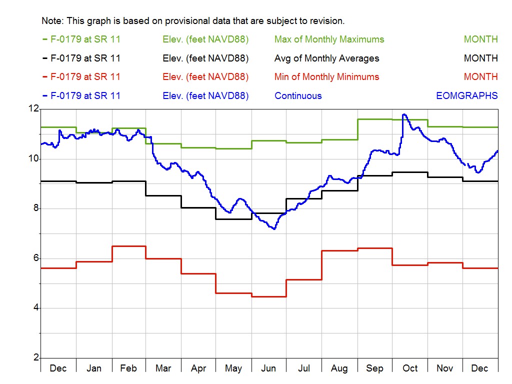
F-0179
Flagler County
F-0294
Flagler County
L-0040
Lake County
L-0043
Lake County
L-0062
Lake County
M-0025
Marion County
M-0026
Marion County
N-0320
Nassau County
P-0270
Putnam County
S-0025
Seminole County
S-1014
Seminole County
SJ0029
Seminole County
V-0101
Volusia County
V-0510
Volusia County