

The District’s three tools of flood protection
UPDATED 12/17/2024
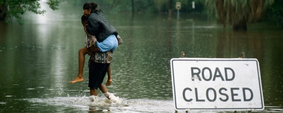
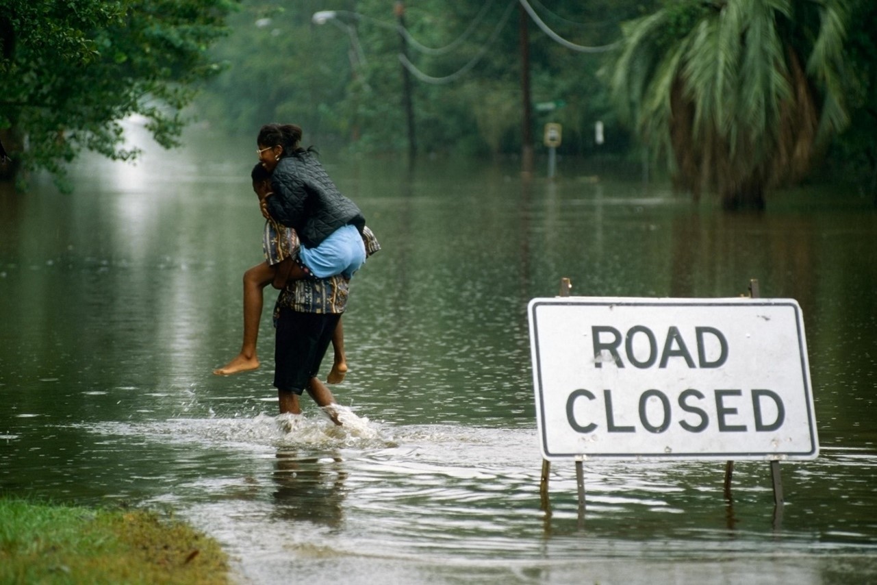
The National Oceanic and Atmospheric Administration (NOAA) is predicting the 2022 Atlantic hurricane season will be busier than normal. This is a good time to remember that even when a storm does not make landfall, heavy rainfall can still cause flooding. Low-lying and coastal areas are particularly vulnerable – whether in an identified flood zone or not.
“Flood protection is about preparation and building resiliency,” says St. Johns River Water Management District Executive Director Mike Register. “We have an innovative team of engineers, scientists, hydrologists, and land managers working to protect people and property from damaging floods.”
“I view our flood protection in three parts,” explains Dr. Erich Marzolf, the Director of the Division of Water and Land Resources at the District. “We preserve the floodplains of rivers and lakes. These undeveloped wetlands can safely store floodwaters. Secondly, we have a structural water management system, based on levees and water control structures in the Upper St. Johns and Ocklawaha rivers. Finally, we collect and share real-time data on water levels with the U.S. Geological Survey, which the National Weather Service uses for its flood predictions.”
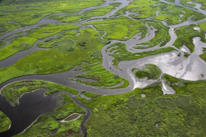
St. Johns River floodplain
Wetland floodplains:
Florida’s environment already provides some of the best natural protection against floods. Wetlands and floodplains act as natural sponges, soaking up rainfall. Trees, shrubs and other wetland plants slow down and help disperse floodwaters. The District owns over 775,000 acres of land, including floodplain wetlands that line the St. Johns River. A key part of the District’s flood protection approach relies on undeveloped floodplains storing floodwaters.
In terms of water storage and flood protection, the wetlands of the Upper St. Johns River Basin in Brevard and Indian River counties hold an estimated 500,000 acre-feet of water; that is enough rain to cover the 200,000-acre project in 2.5 feet of water. The Upper Ocklawaha River Basin in Orange and Lake counties can store up to 62,200 acre-feet of rainfall.
Gates, levees, spillways and canals:
In the Upper St. Johns River Basin and Upper Ocklawaha River Basin, the District manages a system of spillways, pump stations, levees, and canals. Using these structures, the District can influence water levels for additional flood protection. Each year, prior to hurricane season, engineers increase the storage capacity in these areas by lowering the existing water levels. These are the only areas that the District has any control over water levels.
In total, the District currently maintains 115 miles of U.S. Army Corps of Engineers (USACE)/District constructed flood control levees, 175 miles of farm/project levees, 12 major flood control structures, 113 minor water control structures, 25 weirs, and 11 pump stations. In addition, the District maintains 90 miles of canals, more than 1,600 miles of roadways and trails, and three navigational locks. Flood protection in the Upper St. Johns River Basin began in response to devastating floods in the 1940s and continues today. Staff regularly inspect and maintain these manmade structures to ensure they are properly operating and ready when needed.
This combined natural and structural flood protection approach prevented flooding in Brevard, Indian River and Lake counties during hurricanes Matthew in 2016 and Irma in 2017.
Monitoring and modeling:
The District and U.S. Geological Survey cooperatively maintain a network of water level and flow monitoring stations along the St. Johns River and its tributaries. The real-time data from these sites is used by the National Weather Service in its flood predictions, which are available on the Southeast River Forecast Center website at https://www.weather.gov/serfc/.
Daily flood protection relies on having access to accurate water level and rainfall data, as well as weather and hurricane forecasts. Soon, the District will have another tool to help advance flood protection efforts. Using data and information about how water moves through different types of vegetation, soils, terrain and around structures, engineers are developing a new computer flood model for the Upper St. Johns River Basin. Not only do these models allow staff to analyze past events and design storm simulations, but also, by adding current water level data and weather forecasts, they can forecast water levels for specific areas up to 10 days in advance.
The simulations incorporate rainfall forecasts for every square kilometer, improving predictions of how waterways will be affected locally. These models, years in development, are currently being tested and refined for use early next year. This type of advanced forecast modeling can help District staff make decisions about how much and when to open or close water control structures. The models will also be a tool for planning flood protection activities when severe weather events are forecasted, such as back-to back storms.
While advancements in technology help the District with flood protection, there are limits to what the District systems and lands can manage. The water control structures can reduce the amount of water flowing north from the Upper St. Johns River Basin. However, large tributaries, such as the Econlockhatchee River, can contribute more water to the middle St. Johns River than the amount flowing from the headwaters. Downriver of the upper basin project, there are no comparable water control structures and flood protection is provided by the non-structural floodplain wetlands and ever improving water elevation information and predictions.
Also consider that tides and storm surge from the ocean influence the middle and lower St. Johns River. Water levels in the northern reaches of the St. Johns can rise with little advance notice, like during 2017’s Hurricane Irma where westerly winds and high tides pushed ocean water up the river, flooding sections of Jacksonville and slowing drainage throughout the river.
Multiple agencies are responsible for flood protection and response. City and county governments manage stormwater and drainage systems. The District and the Florida Department of Environmental Protection (DEP) issue permits to install stormwater systems; local government, developers or homeowners’ associations are responsible for maintenance. During a storm, localized heavy rains can create regional flooding. If you experience flooding, your first contact should be your local government.
Property owners play a vital role in preparing for hurricane season, which officially runs through Nov. 30. You can protect yourself and your property by:
- Keeping debris out of storm drains and ditches.
- Reporting clogged ditches and culverts to local governments.
- Retrofitting buildings to make them watertight.
- Cleaning out gutters and extending downspouts at least four feet from structures.
- Determining who is responsible for maintaining your neighborhood’s stormwater pond(s) — it may be the homeowners’ association.
- Obtaining flood insurance through the National Flood Insurance Program.
To learn more about flooding – from prevention efforts to response and your role in proactively protecting yourself and your property – please visit www.sjrwmd.com/localgovernments/flooding.