

May rainfall relieves drought conditions Districtwide
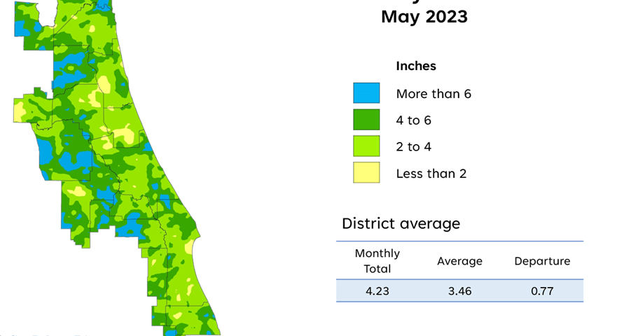
A map illustrates rainfall conditions in May across the St. Johns River Water Management District.
PALATKA, Fla., June 13, 2023 — May brought average to above-average rainfall to the St. Johns River Water Management District’s 18-county region, and according to the U.S Drought Monitor, relieved all drought conditions Districtwide, with the exception of a small area in northern Lake County.
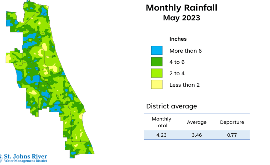
A map illustrates rainfall conditions in May across the St. Johns River Water Management District.
A full report outlining May’s hydrologic conditions was presented at the District’s Governing Board meeting Tuesday. Highlights include:
Rainfall
- Districtwide, May rainfall averaged 4.23 inches, which is .77 inches above the average for the month.
- Districtwide, the cumulative rainfall total for the past 12 months is 51.01 inches, which is .42 inches below the long-term average.
- Rainfall over the past 12 months was well below average in the northern counties with Nassau, Duval, Baker and Alachua all receiving more than 7 inches below average.
- Orange, Volusia and Seminole counties all received more than 7 inches above the annual average.
Groundwater
- At the end of May, Upper Floridan aquifer conditions (groundwater levels) remained mostly in the normal range throughout most of the District, except for a region in eastern Duval and north St. Johns counties, where aquifer conditions were in the low range.
- Groundwater levels expressed as a single Districtwide index are at the 60th percentile, which is in the normal range for this time of year.
Spring flows
- The mean monthly flow at Silver Springs is in the low range for this time of year at 510 cubic feet per second (cfs), or 329 million gallons per day (mgd), which is a 37 cfs decrease from April’s mean.
- At the Blue Spring station in Volusia County, the mean monthly flow was 144 cfs, or 93 mgd, which is in the normal range.
- At Rock Springs, the monthly mean flow decreased slightly but remains in the high range with a decrease of 1 cfs to 61 cfs (39 mgd).
- Mean monthly flow at Wekiwa Springs is in the high range for this time of year at 67 cfs (44 mgd).
To learn more about rainfall totals and other hydrologic data collected, visit www.sjrwmd.com.
Visit WaterLessFlorida.com for tips to help landscapes thrive while saving water and money. Follow the water conservation conversation at #sjrwmd #waterconservation #savewater.