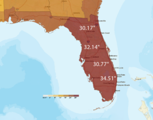
October delivers uneven rainfall as La Niña sets in
at
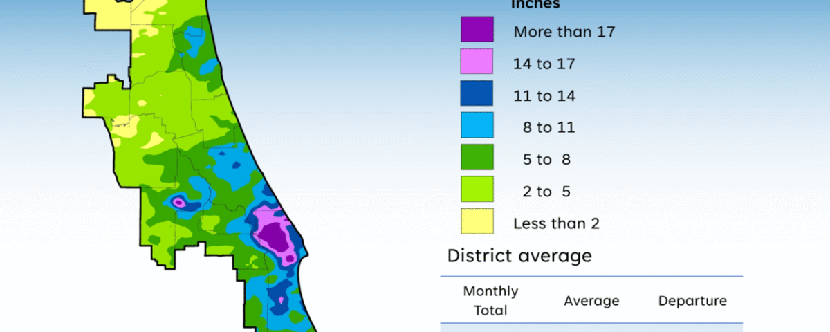
A map illustrates rainfall conditions in October across the St. Johns River Water Management District.