Following Agua’s lead, Hydro freezes and melts, changing between several states of matter. Along the way, we learn how heat and cold impact the water cycle. Hot on Agua’s trail, Hydro evaporates and lands in a cloud, where a clue from Agua sends him on a geographic quest, exploring watersheds in Florida.
After watching the video and finding all the 22 clues in Florida and the 12 links in the Water in the United States page, test your new knowledge with our online quizzes.
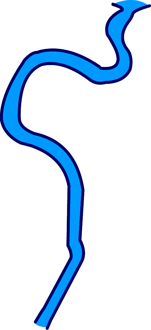
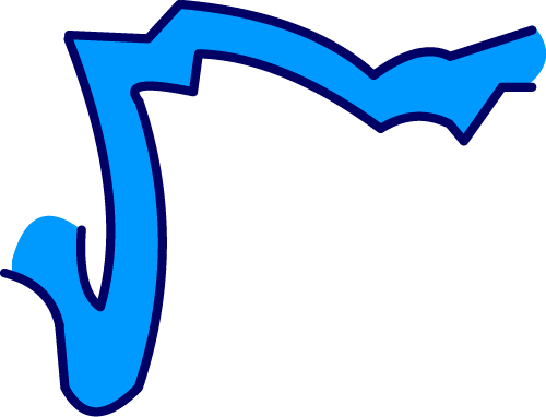
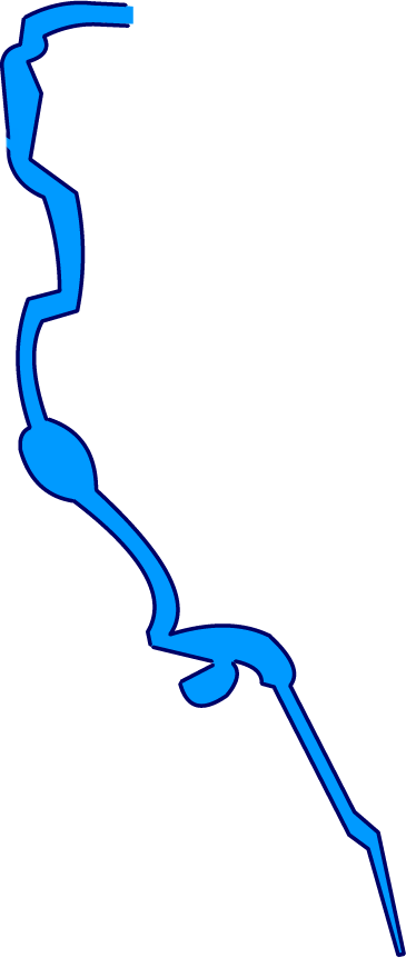
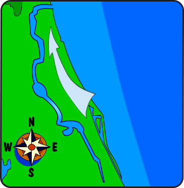
Instructions: Another way to think about the water cycle is the corresponding changes in states of matter of water. Water changes its form many times in Florida! Move your mouse over the different areas of the picture and click to read information or hear a description about this map. Can you find all 22 pieces of information? This webpage is best viewed at a minimum width of 1250 pixels.
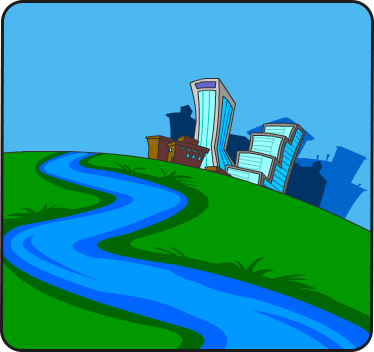
A river is a natural stream that empties into an ocean or a lake or other body of water.
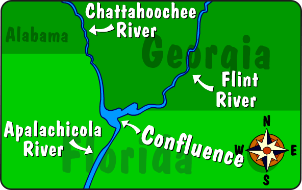
Apalachicola River
The Apalachicola River is formed by the confluence of the Chattahoochee and Flint rivers. A confluence is where two rivers join together. The Apalachicola River flows through the Jim Woodruff Dam just south of the Georgia-Florida border in the Florida Panhandle. It’s one of the few Florida rivers that has a dam. The river flows 109 miles through relatively undeveloped coastal plain into Apalachicola Bay.
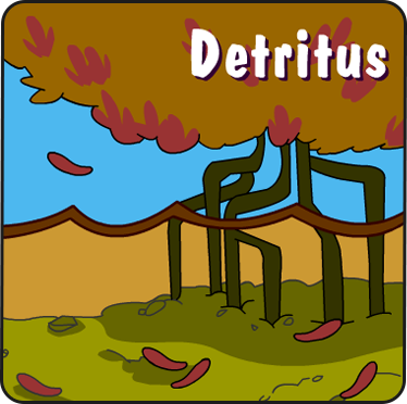
Detritus
Many Florida rivers have a naturally brown color from decaying leaves and plant material, which is called detritus. This decaying material contains tannins that stain the water just like tea.
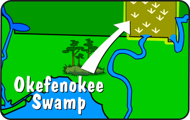
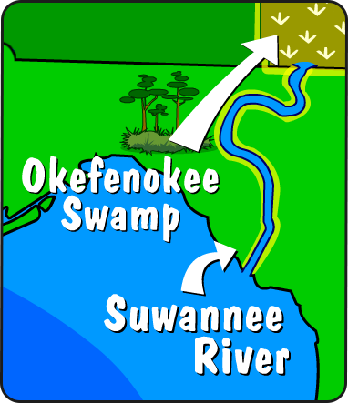
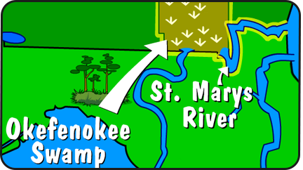
Okefenokee Swamp
The Okefenokee Swamp is one of the largest swamps in North America. Okefenokee, which in the Seminole language means the Land of Trembling Earth, is made up of approximately 700 square miles. It is located in the southeast corner of Georgia. This swamp is the beginning, or headwaters, of both the Suwannee River and the St. Marys River.
Suwannee River
The Suwannee River flows out of the Okefenokee Swamp in Georgia, south to the Gulf of Mexico. Because of its distinctive brown color, it’s often called a blackwater river. More of Florida’s springs are found along the banks of this river than any other river in Florida.
St. Marys River
The St. Marys River forms part of the border between the states of Florida and Georgia. This river begins deep within the Okefenokee Swamp and twists for 130 miles to flow out into the Atlantic Ocean. As the crow flies, it’s only 40 miles from the headwaters to the mouth of this river.
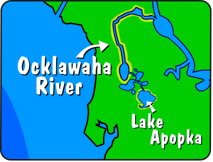
Ocklawaha River
The Ocklawaha River, a tributary of the St. Johns River, begins south of Lake Apopka and flows north. A tributary is a river that flows into a larger river. Some land surrounding the Ocklawaha River was used for farming. In the past, agricultural runoff severely impacted or caused changes to this river. Work is now taking place to restore this region to a more natural system. The Silver River, which is a spring-fed river, is a tributary of the Ocklawaha River.
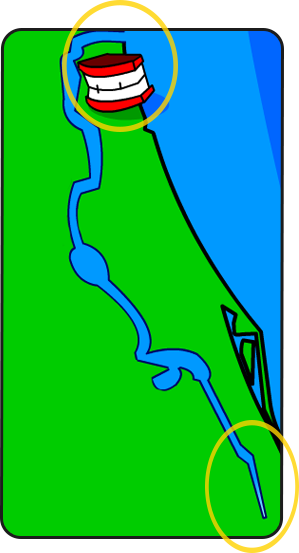
Heads and mouth
Did you know that rivers have heads and mouths? The beginning of the river is known as its headwaters. The river’s mouth is where it ends and flows into another body of water. Can you find the headwaters of the St. Johns River? Hmm?
St. Johns River
The St. Johns River begins in southeast Florida and flows 310 miles north to Jacksonville, where it turns east and joins the Atlantic Ocean.
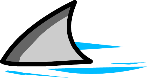
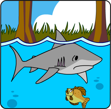
Shark
Have you ever seen sharks in the river? Oh, I hope not. The St. Johns River has a high salt content. That’s why sharks have been found as far as 150 miles upstream.
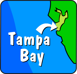
Tampa Bay
Tampa Bay is Florida’s largest open-water estuary. An estuary is a place where freshwater and salt water meet and mix.
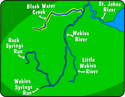
Wekiva River
The Wekiva River begins at the confluence, where two rivers join together, of Wekiva Springs Run and Rock Springs Run. It is joined on its way to the St. Johns River by two tributaries, the Little Wekiva River and Black Water Creek.
River flow
The St. Johns River is one of the few rivers in the United States that flows from south to north.
Indian River Lagoon
The Indian River Lagoon is not really a river or lagoon. It’s really a special place called an estuary. The Indian River Lagoon stretches approximately 156 miles. Its unique location on the east coast of Florida contains both tropical and temperate climates, which allow many different habitats and a wide diversity of species to be found in one area.
The Everglades
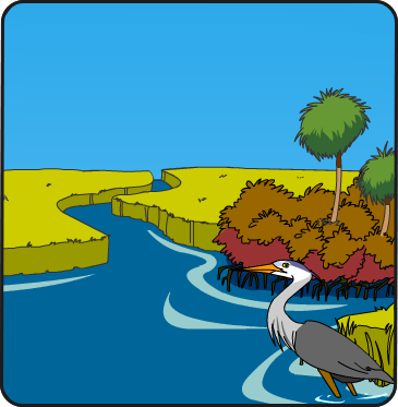
The Everglades is a wetland located in South Florida. Wetlands provide a vital habitat for fish and wildlife, store water and even help filter or clean the water.
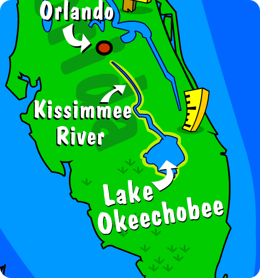
Lake Okeechobee
Lake Okeechobee is one of the largest lakes east of the Mississippi River that is not one of the five Great Lakes. Water from the Orlando area flows down the Kissimmee River into this lake.
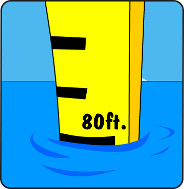
Gauge
The average depth of the St. Johns River is 11 feet. At its deepest point, the river can be more than 80 feet deep.
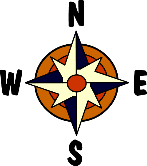
Compass Rose
The compass rose is used to tell directions on a map.
Florida Keys
Key West is the southernmost city in the continental United States and is found on an island in the Florida Keys. An island is a land area completely surrounded by water.
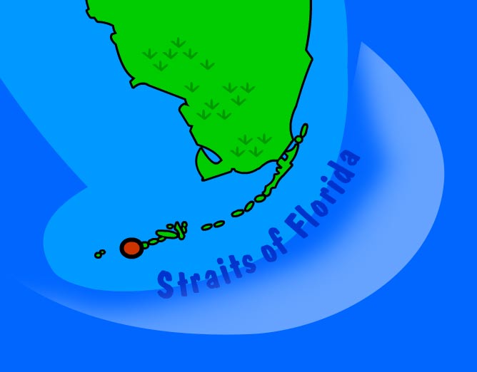
Straits of Florida
The Straits of Florida connect the Gulf of Mexico with the Atlantic Ocean. The Straits are found between the Florida Keys, Cuba and the Bahamas. The Straits mark where the Florida Current, the beginning of the Gulf Stream, flows east out of the Gulf of Mexico.
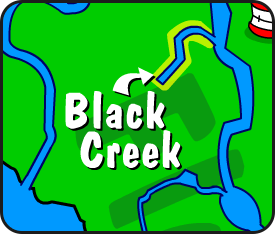
Black Creek
Black Creek is named for its dark water, which is caused by the tannins that run into the creek from forested areas surrounding the creek. High sandy and limestone bluffs are visible in many areas as the creek winds through ravines on its way to the St. Johns River.
Bottle
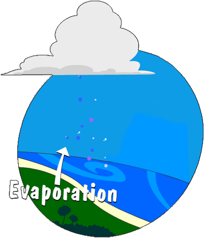
When the sun heats the water to a certain temperature, it causes the water to evaporate and turn into an invisible gas called water vapor. Water is constantly evaporating from oceans, rivers and lakes.
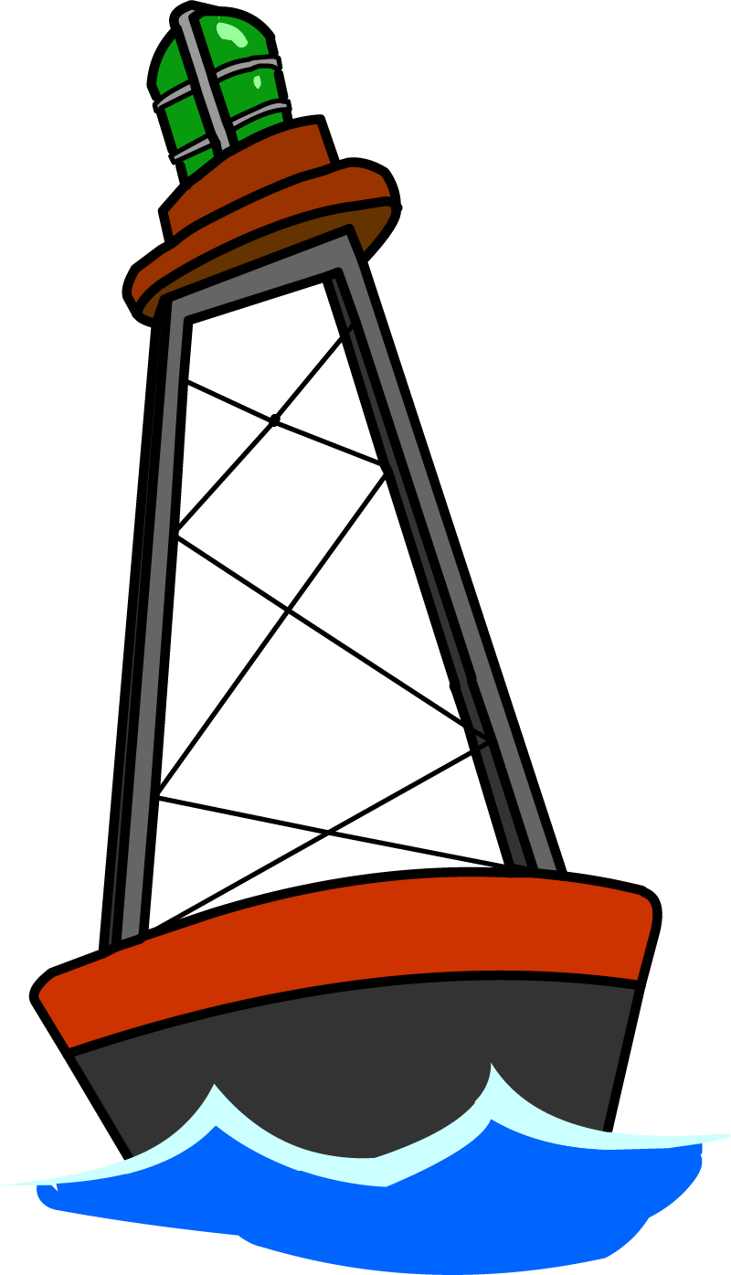
Buoy
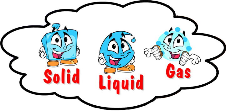
Water is the only substance that is found in nature in the form of a liquid, solid, and gas. All living things need water to survive.