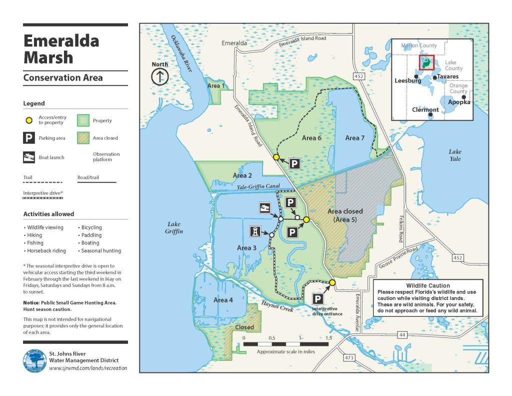
Emeralda Marsh Conservation Area
Recreational activities
- The seasonal interpretive drive is open to vehicular access from the third Friday in February through the fourth Sunday in May. During those dates, the drive is open each Friday, Saturday and Sunday from 8 a.m. to sunset.
- Fishing, seasonal waterfowl hunting (administered by the Florida Fish and Wildlife Conservation Comission, MyFWC.com), hiking, bicycling, canoeing, horseback riding, boating and wildlife viewing.
- The open waters have been stocked with fish by the Florida Fish and Wildlife Conservation Commission.
- A handicapped-accessible wildlife viewing platform is available.


About this property
Historically, Emeralda Marsh extended for more than 10,000 acres on the eastern side of Lake Griffin, near the headwaters of the Ocklawaha River. The district acquired approximately half of this 6,577-acre project area identified by the state’s Conservation and Recreation Lands acquisition program for restoration. In 1974, the area was designated as a National Natural Landmark through a program of the National Park Service. The district purchased this property in 1991 and began restoration here in 1994. As part of the restoration, former farms were allowed to flood from rain and Lake Griffin inflows and water levels were managed to encourage development of wetlands in the former farm fields. Areas 2 (west of Emeralda Island Road and north of the Yale-Griffin Canal) and 4 (south of Haynes Creek) have been connected to Lake Griffin. In 2016 and 2017, additional restoration work was completed, including vegetation plantings and restoring the connection between Lake Griffin and the area west of Emeralda Island Road known as Area 3.
This conservation area is actively managed for the continued restoration of the water resources of Lake Griffin and the Ocklawaha River. The focus of the district’s ongoing water resource efforts here is to reduce excess nutrients flowing into the lake while increasing the coverage of submerged aquatic vegetation through focused efforts to reduce phosphorus and pesticides that remain from past farming activities and to restore connectivity of the marsh systems to Lake Griffin. Land management activities in the marsh areas focus on the restoration and enhancement of natural communities. Uplands are managed to improve important habitat that supports site-appropriate floral and faunal species. Quality recreational opportunities are maintained and developed in a manner consistent with the ecological needs of the property.
Among the special highlights of this property is its seasonal wildlife drive that allows visitors to see the district’s restoration work, view the marsh and see wildlife from the comfort of their vehicle. Visitors may also be interested in a boat launch (open for use during daylight hours) and the observation platform for expansive views of the marsh.
Access
East of Weirsdale. Public parking areas and access are provided off County Road 452. For details and to get driving directions from your location, see the Google Maps link on this page.
Wildlife viewing
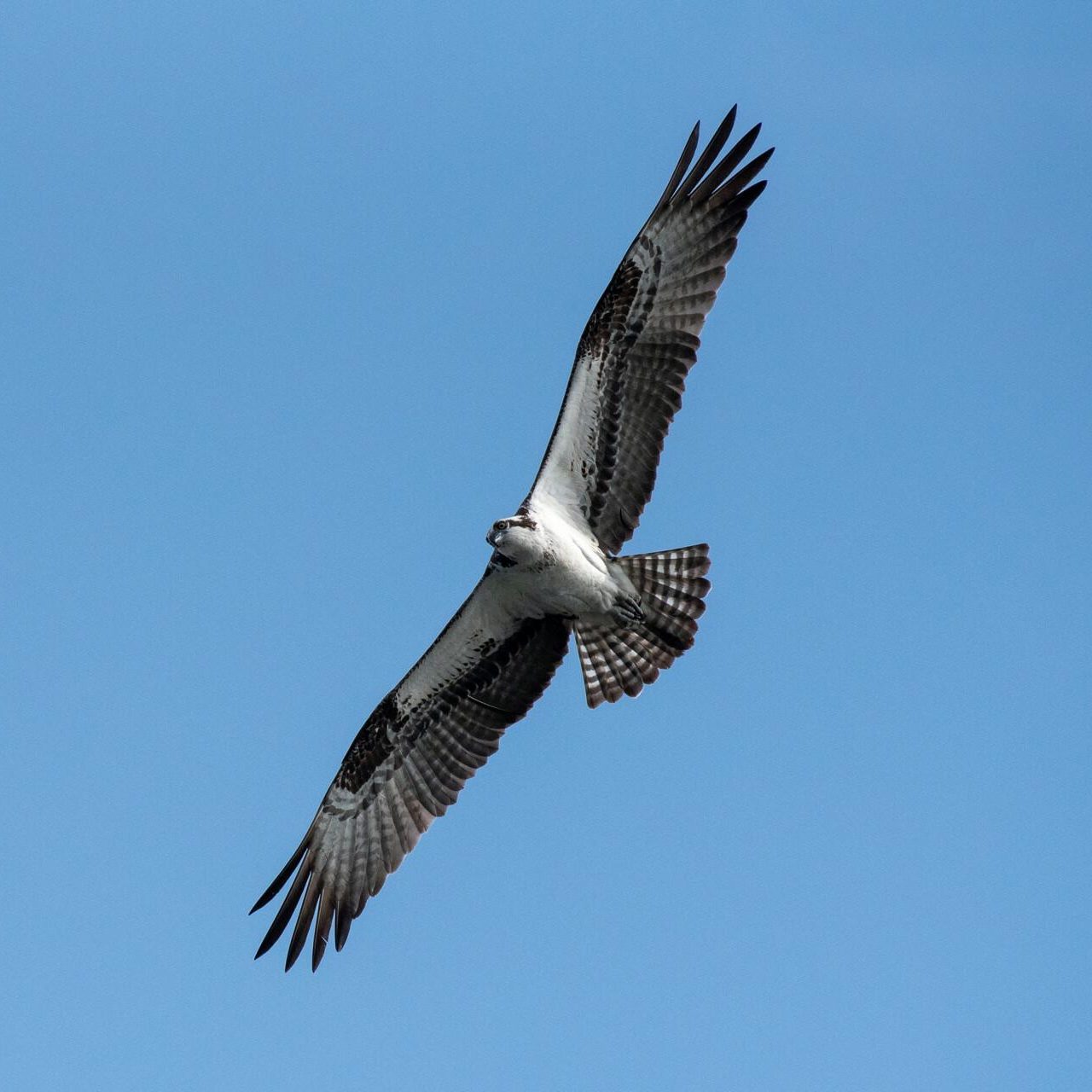
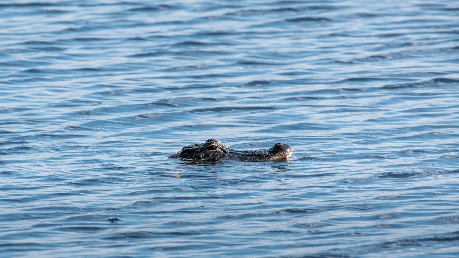
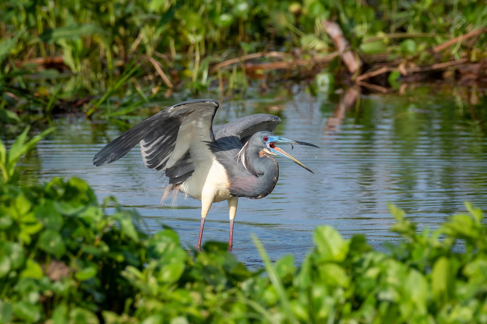
Please respect Florida’s wildlife and use caution while visiting district lands. These are wild animals. For your safety, do not approach or feed any wild animal. The natural communities and agricultural lands support a large and diverse wildlife population, particularly migrating and wintering birds. A large number of the eastern greater sandhill crane population winter in the area. Ring-necked ducks and lesser numbers of wood ducks, green-winged teal, Florida mottled ducks, and many other ducks, as well as bald eagles and flocks of white pelicans and other waterfowl species can be seen in the area. Listed species include wood stork, limpkin and snowy egret. The wetlands and adjacent water bodies support one of the highest concentrations of alligators in central Florida.