Aerial imagery enhances data to support District’s resource management work
June 23, 2022

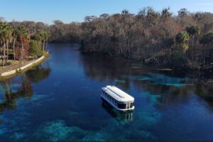
A District drone pilot lands a drone after mapping a restoration project (left). At right, a pilot flies a construction area where a parking lot is being built at a District conservation land in Indian River County.
Guest column: James Walters, Information Technology Manager, Office of Information Technology
Advances in computer mapping software and aerial photography using small, unmanned aircraft systems (sUAS, also known as drones) are helping the St. Johns River Water Management District continue to improve its water resource protection efforts.
In the past when aerial imagery was needed, the District relied on airplanes and helicopters to document the condition of District lands and large restoration projects. Using drones allows staff to capture incredible amounts of information inexpensively compared to costs of traditional aircraft aerial photography.

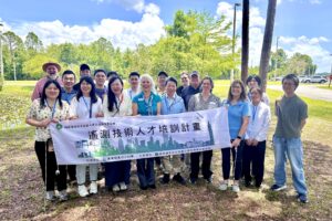
James Walters visits a drone mapping project site
The drones are an asset to the District, allowing staff to quickly visit our properties and collect photos, videos and geospatial data, with GPS accurately pinpointing where images are taken. The information helps staff to make data-driven decisions when they are managing resources on District-owned conservation or restoration areas. Drones are used to map District construction project areas, document pre- and post-treatment and management of invasive vegetation, document restoration efforts (such as wetlands restoration sites), mapping prescribed fires and supporting levee and water control structure projects. While conducting this work, staff ensure the privacy of neighboring property owners.
The District’s drone program is taking advantage of standard and multispectral sensors that captures five precise spectral bands: red, blue and green, as well as red edge and near-infrared (which are invisible to the naked eye). The multispectral sensor enables the District to detect and manage changes in plant communities on its public lands over time. For example, different plants emit individual electromagnetic “signatures,” allowing staff to decipher the information using special software. This helps land managers determine whether an invasive plant species has overrun a plot of land or whether a treatment project has brought them under control.
With trained and licensed drone pilots, the District can quickly fly a project area when needed. Having in-house pilots, including some who are trained geographic information system specialists, has helped in management of endangered and threatened species on District lands. At one conservation area, a land manager needed to know specific details about vegetation height in a habitat to support the threatened Florida scrub jay. The scrub jays forage for food and nest in lower vegetation, while the bird’s predators use higher vegetation to hunt the scrub jay’s young. Staff captured and evaluated aerial photos with several layers of color-coded information, including photo-derived LiDAR, and applied algorithms to determine the vegetation height from the ground to accurately show which areas predators could use and needed to be managed differently for use by the scrub jays.
Learn more about how we use aerial and drone imagery in this webinar.