Celebrate our iconic St. Johns River during National Rivers Month
June 1, 2023

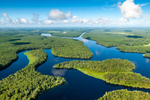
Birds, including black skimmers, wood stork, great egret, black-necked stilts and terns, find habitat in Puzzle Lake, a part of the Middle St. Johns River Basin.

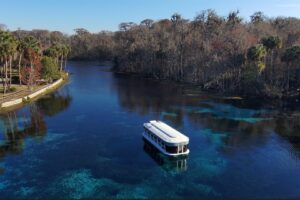
A railway bridge crosses the St. Johns River in Putnam County, a part of the Lower St. Johns River Basin.

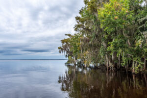
Marshes make up the headwaters of the river. This area is Blue Cypress Conservation Area in the Upper St. Johns River.
June marks the annual observance of National River Month, a time when we celebrate the longest river in Florida — the 310-mile-long St. Johns River.
Our St. Johns River boasts many natural, cultural and historic resources, having long served as a transportation route and home to many indigenous people, supporting trading posts, providing food such as fish and blue crabs, providing recreation and offering unmatched natural beauty. It remains a vital part of Florida’s past, present and future.
As part of the District’s core missions, much of our daily work focuses on the northerly-flowing St. Johns River and the other waterways of our 18-county region. Communities all along the river have benefited from District-led and cost-share projects. These include projects to return historic flows to the river and others to reduce the volume of pollutants flowing off the land, thereby helping to reduce nutrients that feed algal blooms and degrade water quality.
Part of that work includes restoration of almost 200,000 acres of floodplain wetlands at the headwaters of the river. These restored wetlands naturally filter the river’s water, improving water quality and providing floodwater storage. This work has been recognized with the Thiess Riverprize (2008), Project of the Century by the Florida Engineering Society (2016) and featured among the nation’s top restoration projects by the Association of State Wetland Managers (2019).
Our work to protect the river continues. We monitor the river’s ambient conditions for both flow and water quality with a monitoring program that includes more than 40 sites. With the U.S. Geological Survey, we cooperatively monitor flow along the main stem of the St. Johns River at nine stations, and the District monitors another 40 locations along the river and its headwater marshes and tributary systems. All these data are critical to accomplishing our missions to protect water supplies, ensure good water quality, provide flood protection and protect natural systems.
Learn more about this gem among rivers on our website: