Florida’s aquifers: Water beneath our feet

Advancing the understanding of our water supplies
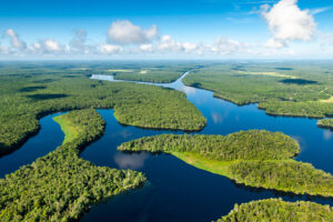
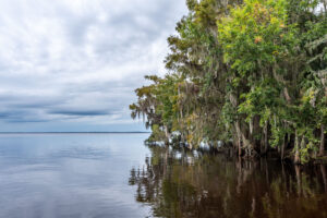
Florida, at times, seems as much a liquid state as it does terra firma. Slosh through its marshes and wetlands, and you will probably agree. We live in a land literally shaped by water, a peninsula boasting more than 1,197 miles of coastline and laced with 50,000 miles of rivers and streams, 7,000 lakes and more than 1,000 known springs.
Most of the water that comes from our collective taps — water we use for drinking, washing, bathing and irrigating our landscapes and crops — comes not from visible flows but from sources deep beneath the ground.
This is a story about Florida’s aquifer system, an underground labyrinth harboring billions of gallons of sparkling water, with a mysterious network of chasms and porous rock and vast layers of clay. The aquifer has inspired enduring legends (think of Ponce de Leon’s futile search for Florida’s Fountain of Youth) and it has helped shape the culture of the Sunshine State. The water ebbing and flowing beneath our feet represents one of the most prolific aquifer systems in the world.
Understanding its complexities is critical to the mission of the St. Johns River Water Management District as it makes daily decisions about water use for its 18-county region.
Florida has five main aquifer systems that serve most of the state’s needs. The Floridan aquifer system is the principal source of freshwater in the St. Johns District, and for the state. This aquifer provides 62 percent of Florida’s groundwater supply (USGS 2015).
The Floridan aquifer underlies most of Florida and extends into parts of Georgia, Alabama, South Carolina and beneath the Atlantic Ocean and the Gulf of America. The aquifer is subdivided into the Upper Floridan and Lower Floridan aquifer, where a middle confining unit separates the two aquifers, with the Upper Floridan aquifer providing 90 percent of the groundwater supply.
“The Floridan aquifer extends to approximately 100,000 square miles and averages 1,000 feet thick,” says Rob Brooks, a District hydrogeologist. He, along with District hydrogeologist Don Lee, is responsible for mapping the aquifer systems. “In 2015, the Floridan aquifer provided approximately 2,360 million gallons per day in groundwater supply, which is a huge volume of water.”
Primarily composed of limestone and dolomite, the Floridan aquifer acts like a sponge by absorbing and holding water. The texture of these rocks, however, does not feel like a sponge at all. They are hard and often full of interconnected voids and crevices that allow water to move freely.
How did the aquifer come to be, and what exactly is the composition of limestone and dolostone? Rewind the clock 55 million years or so, and Florida would have resembled the Bahamas, Brooks says.

“Millions of years ago, Florida contained mud flats, coral reefs, mollusk shells and algae,” Brooks says. “Over time, the calcareous shells and skeletons of expired sea life accumulated and hardened into the carbonate rocks that comprise the Floridan aquifer.”

As the millennia crawled by, the sea level rose and fell, alternately inundating and exposing the peninsula. The Appalachian Mountains to the north eroded and supplied sand and clay to create a veneer of sediment that covered much of the limestone.
A core sample of limestone from the aquifer shows the holes and fractures in the rock that allow water to move underground. Slightly acidic rainwater continues to dissolve the limestone, often creating large cavities that, today, are underwater caves and caverns. This ongoing dissolution has created what scientists call a karst, a landscape which is characterized by a distinctive topography that includes sinkholes, subterranean limestone caverns and disappearing streams, all carved by groundwater.
“The Floridan aquifer is a dynamic system,” Lee says. “The ability of the aquifer to store and transmit water changes in response to changes in water chemistry and even forces that fracture the rocks. Sea level changes of over 300 feet have created varying hydrogeologic conditions. At times of lower sea level, fresh, slightly acidic water flowed through the aquifer system and dissolved the limestone, increasing porosity and permeability. During high sea level, highly mineralized water flowed and filled void spaces by depositing carbonate cement. There is a constant process of mineral precipitation and dissolution.”
Lee’s job is to update three-dimensional models and maps of the Floridan aquifer system. This information provides input for groundwater flow models, which allow the District to perform water supply assessments and evaluate water use permit applications. In simplest terms, District staff can make educated decisions on issuing permits for consumptive uses if they have the best available data and models to inform them about groundwater availability.
By boring holes deep into the ground and using specialized geophysical logging equipment, District geologists map the Floridan aquifer and record information about rock type, flow zones and water quality.
“Numerous reports and studies have been done on the aquifer system,” Lee says. “New information is constantly being generated by the District and other sources that the District compiles into a single mapping framework using our Hydrogeologic Information System (HIS). This tool can be accessed online at the District’s website.
Here you can explore maps of the top elevation of the hydrogeologic surfaces such as the Upper Floridan aquifer, view descriptions of rocks encountered from drilling samples, borehole geophysical and video logs, water quality and water level from wells, and even make cross section slices to see the configuration of the various subsurface units. Be sure to watch the brief demonstration videos provided to learn how to use the HIS.
Knowing where potable water is most plentiful is key to the District’s water supply planning process. Water in the Floridan aquifer may seem limitless, but overpumping can have immediate and long-term impacts on groundwater resources.
The Floridan aquifer is under constant pressure, the result of an endless cycle of recharge and discharge. Recharge occurs when water seeps from the land’s surface down through the layers of earth into an aquifer.

Florida generally receives 50 to 55 inches of rainfall each year, but much of it — about 37 inches per year — evaporates or runs off the land into surface waters before it has a chance to soak into the ground. That leaves about 13 inches annually to recharge the aquifer, in limited areas. Near the coast, pumping too much water from the aquifer can draw saltwater up from deeper zones below the aquifer or laterally from the ocean. Overpumping can also result in a pressure drop in the aquifer, causing spring flows to diminish or wetlands to dry out. Through its consumptive use permitting program, the District reduces the potential for overpumping by requiring water conservation to prevent wasteful uses, the reuse of reclaimed water instead of higher-quality groundwater where appropriate, and sets limits on how much water can be withdrawn from water bodies and the aquifer.
The District’s research and mapping of the Floridan aquifer system may seem intimidating. However, improving our understanding of this critical water source is essential to ensuring Florida and its vital water resources will continue to flourish.