Keeping a close eye on every acre of our land inventory
Nov. 5, 2020

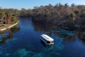
Among the District’s public lands is Moses Creek Conservation Area, which helps protect one of the few remaining undeveloped tidal creeks — Moses Creek, a tributary to the Matanzas River — in north Florida.
The St. Johns River Water Management District owns and manages public lands to help meet our core missions of water supply, water quality, floodplain protection and natural systems protection. Reviewing our diverse land holdings is an ongoing process focused on ensuring we are getting the maximum water resource protection benefits from these properties.
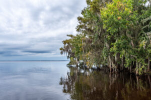
We buy land from willing sellers in the course of our work. These lands largely consist of wetlands or historically wet areas and some upland buffers. The properties provide valuable water quality and flood protection benefits, and some provide critical area for rainfall to refill the Florida aquifer, the source of most of our drinking water. They also offer corridors that safeguard and connect plant and wildlife habitats.
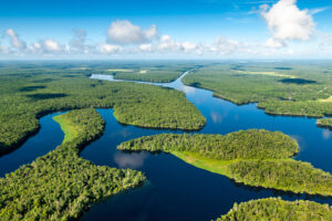
The District owns an interest in nearly 775,000 acres of land throughout our 18-county service area. Of that total, 428,445 acres are directly managed by the District, while the rest is managed with partners such as local governments, state agencies and nonprofit organizations. More than 90 percent of this acreage is open to the public for resource-based recreation such as hiking, birdwatching, fishing, photography and hunting.
Most of these properties have been restored in some way, such as through prescribed fire, restoring the hydrologic regime, or managing nonnative/invasive vegetation. Larger efforts include restoring the former muck farms at the 20,000-acre Lake Apopka North Shore to functioning wetlands to improve the lake’s water quality, hydrologically reconnecting sensitive wetlands along the shoreline at the 10,300-acre Lake Lochloosa Wildlife Management Area in the Orange Creek Basin, and restoring the formerly altered wetlands at the 3,500-acre Orange Creek Restoration Area. But the granddaddy of our hydrologic restoration is in the Upper St. Johns River Basin, one of the largest wetland restoration efforts in the world, providing a wide range of benefits at the headwaters of the St. Johns River.
The District’s Governing Board approves a land management plan developed by staff for each property to identify needs and uses that ensure a balanced approach. Legislative directives guide the land management planning process from pre-acquisition evaluations, to the development of land management plans, through a detailed management review team assessment every five years.
As a part of the evaluation process, the District’s Governing Board initiated a process nearly a decade ago to regularly assess every acre in our inventory, through our Lands Assessment Plan. The goal is to identify lands that no longer meet the original purpose of providing substantive water or natural resource benefits or to determine whether the use of any of the properties should be altered. In a small percentage of cases, land may be identified for surplus.
We know the public is passionate about District public lands, and the diverse wildlife and recreational opportunities they support. Our management and assessment programs are robust and transparent, engaging our agency, interest groups, the public, local elected officials and staff representing partners in the ownership and oversight of these properties.
We are grateful that you have entrusted us with the stewardship of these extraordinary natural resources. Make plans to visit one of our beautiful properties soon.