Satellites to snail kites: How new tech bolsters the District’s efforts to protect endangered species and manage habitat
Aug 4, 2022

Dr. Dianne Hall, a District ecologist, works on a mapping project in her Palatka office.
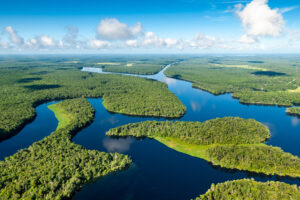
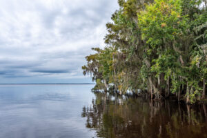
The St. Johns River Water Management District maps all kinds of things: water bodies, trails, roads, monitoring wells, water stations, soil types and vegetation. These maps are tools, helping inform decisions. Mapping vegetation is a key part of protecting the natural resources within District lands.
“This is one of the ways we monitor large areas. Vegetation mapping is a type of biomonitoring — a way of checking the health of the ecosystem,” explains Dr. Dianne Hall, an ecologist with the District. “If wetland vegetation changes, it’s usually because of the hydrology, indicating we’re keeping an area too wet or too dry.” Changes in vegetation can also indicate it’s time to do a prescribed fire, or that invasive species are getting established.
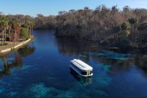
Hall uses vegetation mapping in her efforts to manage habitat for the federally endangered snail kite in the Upper St. Johns River Basin. Snail kites need a balance of vegetation for nesting, like cattails and sawgrass, and open water areas where they can forage for their sole food source, apple snails. Cattails can provide nesting sites, but too many cattails will interfere with the birds’ ability to find the apple snails. Maintaining a suitable balance of habitats is essential for snail kites to continue to use the area.
Vegetation mapping can be time intensive. First, planes fly the area and capture images. Next a cartographer sits down at a computer with the aerial images and, using mapping software, draws digital boundaries around each different patch of vegetation. Then there’s ground truthing – going out in the field to check that the map created from the aerial imagery is accurate.
The District owns more than 780,000 acres, directly managing more than 430,000 acres. From start to finish, completing a vegetation map of the just the 10,000-acre Fellsmere Water Management Area in the St. Johns River’s upper basin can take several months to complete. Mapping the entire upper basin takes over three years. Then, because change is constant, it will need to be mapped again, and again and again. This can be very time-consuming if everything is being done manually.
There could be a faster way: vegetation mapping, meet satellite imagery and artificial intelligence.
Recently, Hall and her colleagues attended a tutorial given by Dr. Caiyun Zhang from Florida Atlantic University (FAU). Dr. Zhang is a leader in Remote Sensing (detecting and monitoring physical changes on earth using cameras on satellites) and machine learning (teaching a computer how to map different objects). Under a contract with the District, she developed an automated technique to map vegetation using satellite imagery and computer modeling software.
It starts with understanding how wavelengths of light are absorbed and reflected. Plants look green to us because the green wavelength is reflected. Red, infrared, and blue wavelengths are absorbed by chlorophyll and converted to energy (photosynthesis). There are many different wavelengths of light beyond what humans can see and every different type of plant reflects and absorbs these wavelengths of light in a unique way. Computer modeling programs can analyze these wavelengths and identify differences between the absorption and reflection patterns. The software outlines the areas with different reflectance patterns onto the mapped imagery. That allows you to assign a specific plant community to each reflectance pattern.
Some projects require mapping to the species level: you may need to know if areas of cattail are expanding. Sometimes, you may need to know if management strategies for certain groups of species, likes shrubs, is being effective over a large area. Using a section of the area they want to map, Hall and her colleagues dial-in the level of detail they need. The greater the level of detail, the more time it takes. However, using machine learning, the mapping can be done much quicker, and several models can be tested in a short period of time.
The computer models cannot identify plants or vegetation types. So, they rely on someone to “teach” them. This is where the on-the-ground expertise comes in. Hall and her team have to “train” the models on what plants create each signature pattern of light absorption. If Hall knows from her experience (and past mapping) that the plants in an outline that create a specific signature pattern are cattail, she teaches the models this pattern means cattail. The models then apply the labels throughout the mapping area. It’s a process similar to training the face recognition software for photos; when you label a face in a few photos the label is applied to all the photos of that individual in your photo catalogue.
“The more you teach the models, the better they will learn,” explains Hall. The models will be more accurate when they have a larger number of sites to learn from. For example, you have to show the models many different sites with cattail before the model learns the reflectance pattern means cattail. Consequently, it is very hard to teach the models to recognize communities that are very small or rarely occur in an area. And some models are better learners than others.
Checks for accuracy are built into the process.
FAU’s Zhang created a script to help speed up the mapping process. If three models agree that a particular outline is cattails, then the script labels the shape as cattail, if two of the three agree on cattail, then cattail is selected. If all three differ, the script selects the most accurate model, based on a statistical likelihood of accuracy.
Based on what she’s seen so far, Hall thinks this method could cut the time it takes to map vegetation communities in half, reducing lag time between when something changes on District lands and when the District learns about it. This can help land management teams better protect habitat for threatened and endangered species such as the snail kite, evaluate prescribed burns, and select the appropriate way to remove invasive plants.
“Quick turnaround on vegetation mapping can help us make informed management decisions,” says Hall. Hi-tech tools, like satellite imagery, combined with well-trained computer models will enhance on-the-ground management.