

Structures, other measures help deal with flooding potential year-round
June 22, 2023

The S-96B structure (left) in the headwaters of the St. Johns River. Marshes of the Three Forks Conservation Area (right) store flood waters.
As we keep a watchful eye on the weather during hurricane season and the potential flooding a storm can bring, it’s important to understand how water levels are managed in the region.
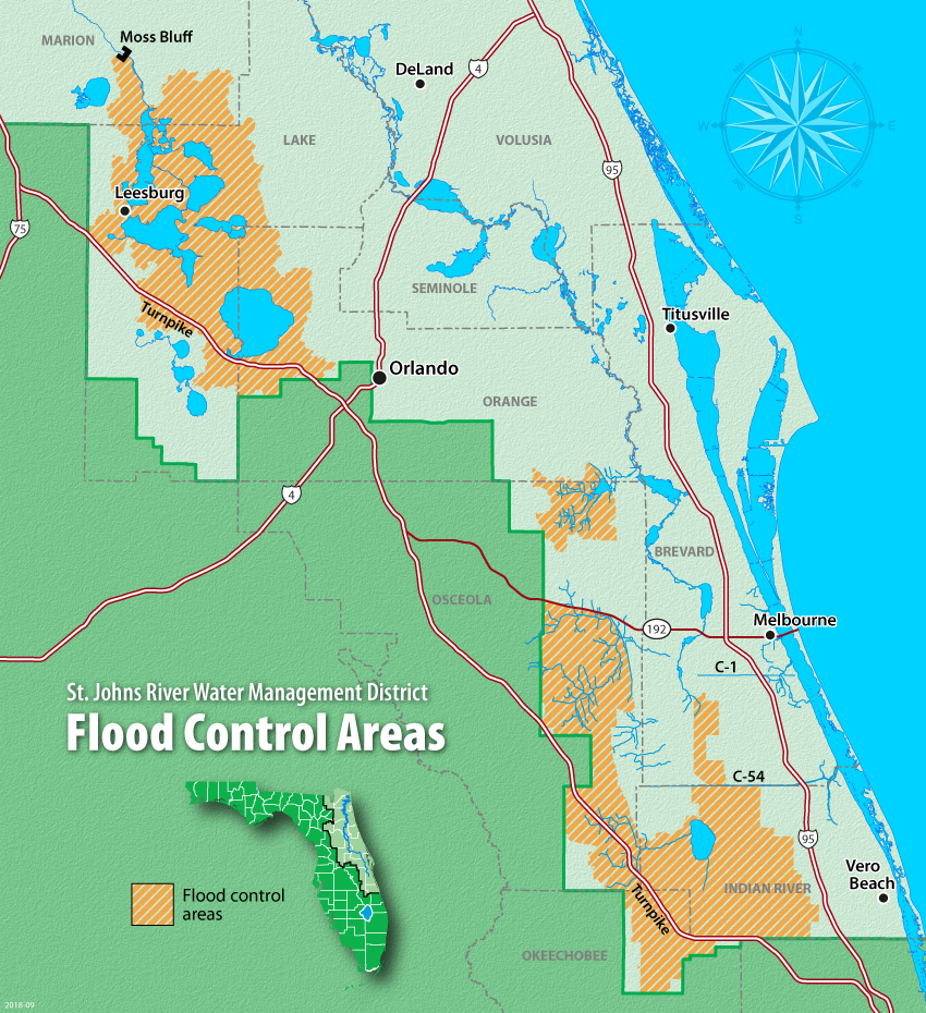
The St. Johns River Water Management District does not directly control water levels in the St. Johns River itself. However, a combination of federal and District projects provides flood protection benefits in portions of the Upper St. Johns and Upper Ocklawaha River basins. These projects, which we consider “structural flood protection” are a part of the District’s flood protection core mission. The largest of the District’s structural flood protection projects lies in the Upper St. Johns River Basin, where we operate and maintain eight major water control structures, numerous minor water control structures, and regulate water elevations across large areas of marsh that serve as the headwaters of the St. Johns River. In the Upper Ocklawaha River basin, the District operates and maintains four major water control structures that regulate the water elevations in five of the larger lakes in the area.
It’s important to recognize that the District’s flood protection projects’ benefits do not reduce flooding in east-central Florida (the St. Johns River’s middle basin), including Lake Monroe, nor further downstream in the St. Johns River’s lower basin in north Florida. This is because after waters discharge from the federal and District projects, numerous tributaries with large watersheds contribute water to the river’s flows.
In addition to structural flood protection, another key element of the District’s flood protection core mission is “non-structural” flood protection, which refers to the District’s policies of acquiring lands in the floodplains of the major water bodies and working with nature to restore wetlands, which provide storage of flood waters during large storm events.
Finally, the District’s Environmental Resource Permitting Program helps mitigate flooding in areas outside the District’s properties by requiring permits and stormwater management facilities for new or revised development sites, and that new drainage ditches or significant changes to existing ditches are coordinated regionally.
Learn more about our flood protection role, our collaboration with local governments and see a map of our flood protection areas.


