Take a hike for Florida Hiking Trails Month
Feb. 22, 2024

Colored diamonds and activity icons mark trails suitable for hiking on District conservation lands.
Looking for an excuse to spend some time outside? Celebrate Florida Hiking Trails Month! Whether you’re by yourself or with others, hiking is a terrific opportunity to enjoy the outdoors, get some exercise and appreciate wildlife. As February unfolds, embrace the spirit of adventure and explore the diverse network of hiking trails within the many St. Johns River Water Management District properties.
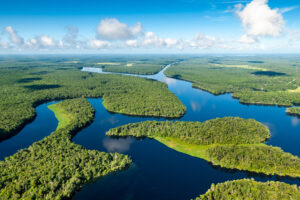
Throughout the course of its work, the District buys land to protect and preserve water resources. Approximately 430,000 acres of land are managed by its Bureau of Land Resources and the many diverse conservation areas cover a wide range of landscapes, from coastal marshes, lakes, rivers and isolated wetlands to maritime forests, pine flatwoods, sandhills, live oak hammocks and open fields. These properties all play a vital role in the protection of our water resources, but they also help to conserve our natural ecological communities, protect critical wildlife habitats and provide outdoor spaces for public recreation and environmental education.
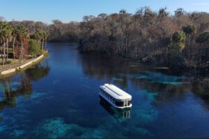
February’s mild weather makes it the perfect time to discover the outdoors, and with 42 properties containing over 530 miles of multi-use trails spread throughout the District’s 18-county service area, a prime hiking spot is just a short drive away. Each property offers passive recreational activities where visitors can experience a piece of undeveloped Florida. Users can dedicate as much time as they want, whether that’s an hour or two strolling on a short trail or a couple of days hiking and camping at a primitive tent campsite. The best part is District lands are free to enter, and the majority are open for non-vehicular recreational activities 24 hours per day, 365 days per year.
Whether you’re new to hiking or an outdoors enthusiast, you should plan accordingly before visiting a District property. Drinking water, sunscreen, insect repellent and comfortable shoes are all essentials. Most District lands are remote, open areas, and while they are popular, they aren’t typically crowded. This means you’re more likely to see wildlife such as birds, turtles, alligators or even black bears or bobcats, depending on the time of year and location. Properties are maintained to preserve their natural environment, allowing for solitude and tranquility with limited facilities and infrastructure.
The biggest question is, where should you hike first? You can see which properties are close to you by viewing the District lands map. Once you’ve decided on a location, check out the recreation website, where you’ll find information such as property descriptions, driving directions, and downloadable trail maps. You can even see your exact location on the property while you explore by downloading a PDF mapping app of your choice, such as Avenza, to your smartphone.
Still looking for inspiration? Check out these suggestions from the District’s land managers:
North Region Land Manager Tyler Mosteller recommends the white and red trails at Black Creek Ravines Conservation Area in Clay County. The white trail overlooks one of the ravines that traverses the property, which is unique to north Florida. The red trail ends at a bluff along Black Creek, which is about 30 feet above the creek, providing a breathtaking view.

The bluff at the District’s Black Creek Ravines Conservation Area overlooks Black Creek.

Trees provide shade along the red trail at Lake Monroe Conservation Area.

Seasonal wildflowers bloom throughout Longleaf Flatwoods Reserve.
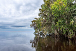
The red trail at Lake Monroe Conservation Area in Volusia County is one of South Central Region Land Manager Graham Williams’ favorites. It’s an out-and-back hike that passes through diverse habitats, including oak and palm hammocks, open marshes and pastures, and along the scenic shoreline of a section of the St. Johns River. At the end, there is a small shelter in a shady spot at the water’s edge where you can take a break before making the walk back.

The boardwalk at Fort Drum Marsh Conservation Area takes you through a blackwater hardwood swamp.

Sunnyhill Restoration Area restores wetland functions on the Ocklawaha River floodplain.
West Region Land Manager Amy Copeland suggests checking out Longleaf Flatwoods Reserve in Alachua County. It has multiple trails that wind through mesic flatwoods and sandhill upland natural communities, as well as wildflowers that bloom seasonally.
Fort Drum Marsh Conservation Area in Indian River County is a personal favorite of South Region Land Manager Jonny Baker. He suggests starting at the Horseshoe Lake parking area (free day-use permit required) and hiking the half-mile trail to get to the wooden boardwalk. The boardwalk meanders through a blackwater hardwood swamp, covered by cypress and cedar trees and sabal palms. This property can be very wet at times, particularly in the summer or after regular rainfall.
North Central Region Land Manager R.H. Davis recommends hiking one of the tracts at Sunnyhill Restoration Area in Marion County. The South Tract offers several trails through wooded areas and cattle pastures, giving a glimpse into old Florida along the way. The North Tract has a nice mix of levees and wooded trails with plenty of wildlife viewing opportunities. Finally, the West Tract has over 6 miles of trail with a spur to a picnic area along the bank of the Ocklawaha River.
Southwest Land Manager Ben Gugliotti suggests trying out one of the many trails at Lake Apopka North Shore in Lake and Orange counties. The red trail, a hidden gem of the property, is a 2-mile loop that winds through a lush oak forest. The Clay Island Loop has four observation towers offering great views of Lake Apopka and the property. The Wildlife Drive, which is open to vehicles Friday through Sunday and on federal holidays, is accessible anytime to hikers and is a birder’s paradise.
For more information about hiking opportunities and other recreational activities on District lands, please visit www.sjrwmd.com/lands/recreation.

The sun rising on Lake Apopka, as seen from the lakeside observation tower on the Clay Island loop.