Take our District lands quiz!
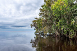
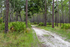
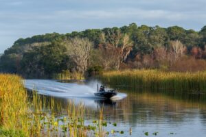
If you love the outdoors, you may have explored some of the St. Johns River Water Management District’s public lands. Maybe you were avoiding crowds before it became (social distancing) fashionable; maybe you were looking for a family adventure that doesn’t require an entrance fee (our properties are open to the public free of charge).
How well do you know District lands? Let’s find out. There are more than 41 properties listed in our online directory, but we’ve chosen six scenic photos from our vast archives to test you.
It’s not as easy as it sounds! We own or manage more than 772,00 acres of land throughout our 18-county District and virtually all of it is open to the public for activities that are compatible with conservation, such as hiking and birdwatching. (We buy land in the course of our work to protect and preserve water resources.)
If you don’t know anything about District lands, perhaps our quiz will inspire you to get out there and learn more. You’ll find marshes, forests, foot bridges, observation towers and of course abundant wildlife. This the real Florida ― the land of heat, humidity and mosquitos ― so be sure to bring water, mosquito repellant, a cell phone (in case of an emergency or to snap a photo), sunblock and a hat. Given the times we’re living in, it’s a good idea to follow CDC guidelines, too.
And now for our multiple-choice quiz. Answers are at the bottom.
1.

A. Stokes Landing Conservation Area
B. Moses Creek Conservation Area
C. Rice Creek Conservation Area
D. Lake Monroe Conservation Area
2.

A. Lake Norris Conservation Area
B. Rice Creek Conservation Area
C. River Lakes Conservation Area
D. Fort Drum Marsh Conservation Area
3.

A. Bayard Conservation Area
B. Moses Creek Conservation Area
C. Buck Lake Conservation Area
D. Clark Bay Conservation Area
4.

A. Deep Creek Conservation Area
B. Murphy Creek Conservation Area
C. Rice Creek Conservation Area
D. Pellicer Creek Conservation Area
5.

A. Sunnyhill Restoration Area
B. River Lakes Conservation Area
C. Seminole Ranch Conservation Area
D. Palm Bluff Conservation Area
6.

A. Stokes Landing Conservation Area
B. Wekiva River Buffer Conservation Area
C. Twelve Mile Swamp Conservation Area
D. Silver Springs Forest Conservation Area