Key messages:
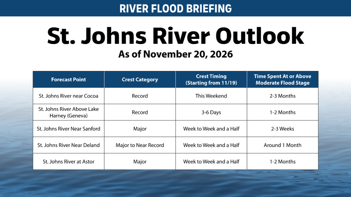
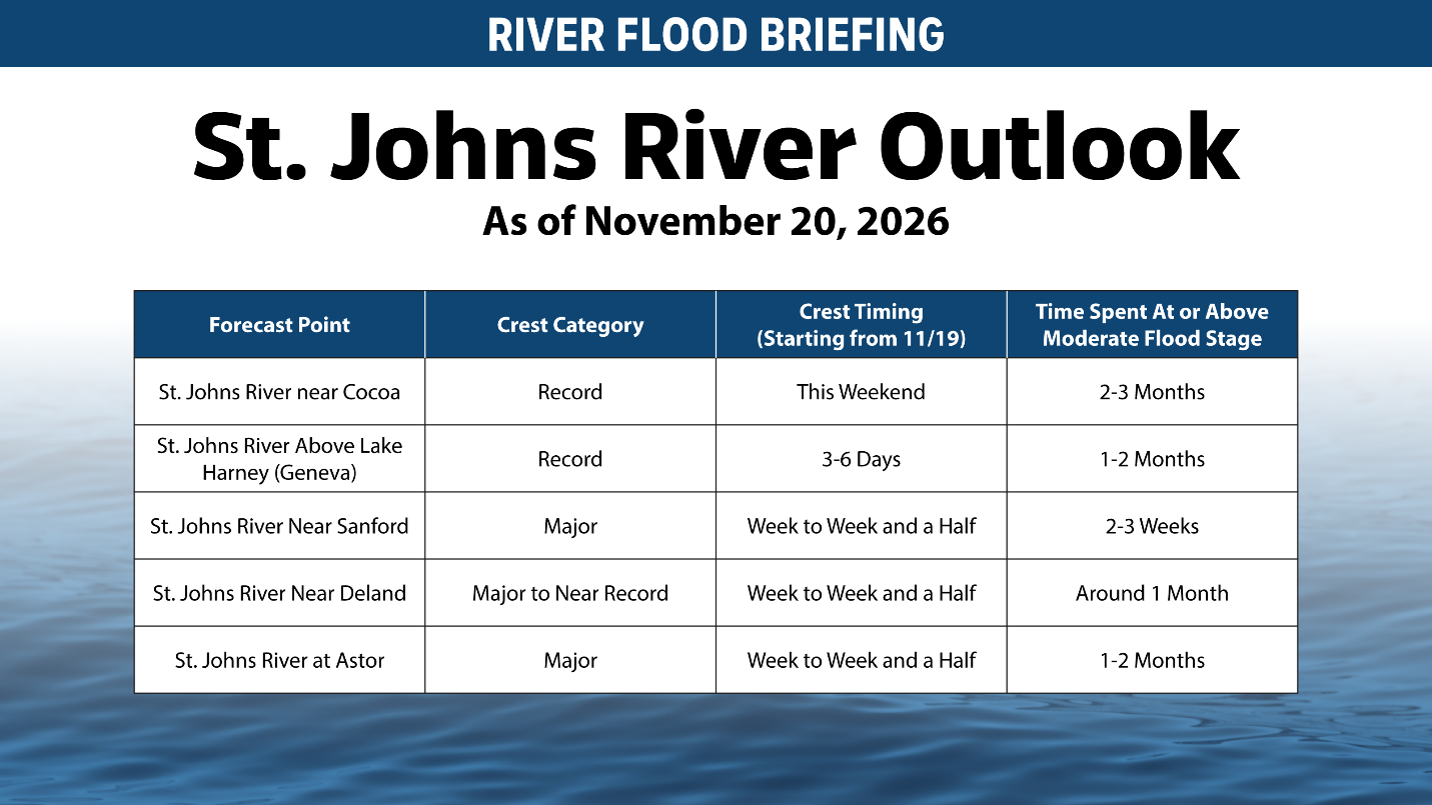
- Many portions of the St. Johns River have not yet crested.
- Water levels may continue rising for days, and in some areas, more than a week.
- Strong northeast winds could elevate water levels and slow drainage through Saturday.
- King tides beginning Sunday, Nov. 22 may prolong high-water conditions in tidal areas.
- The District continues holding as much water as safely possible in the Upper Basin to help reduce downstream impacts.
- It could take months for the St. Johns River to drop below moderate flood stage.
PALATKA, Fla., Nov. 20, 2026 — Water levels along the St. Johns River continue to rise as floodwaters move through the watershed following widespread rainfall across Central and Northeast Florida.
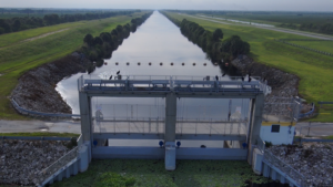
The St. Johns River Water Management District is closely monitoring river conditions across the basin and continues managing water levels within the Upper St. Johns River Basin. Where storage is available, the District is holding as much water as safely possible to help reduce downstream impacts while balancing conditions throughout the broader river system.
The slow-moving nature of the St. Johns River plays a significant role in how floodwaters move through the watershed. The 310-mile river has approximately 200 miles of riverbed below sea level and drops only about one inch per mile from its headwaters to the Atlantic Ocean. As a result, water continues moving through the system long after rainfall occurs, and river levels can continue rising even after the rain has ended.
In addition to rainfall and runoff, coastal influences are expected to affect water levels along portions of the river in the coming days. Strong northeast winds through Friday and Saturday could push water southward, or upstream, slowing the river’s ability to drain and contributing to elevated water levels in communities along the river corridor, including areas as far south as Lake George.
Beginning Sunday, Nov. 22, king tides are expected to increase water levels along the lower St. Johns River and throughout tidal portions of the watershed. The combination of elevated upstream flows, persistent high-water conditions and higher-than-normal tides may further influence water levels in some areas and could prolong flooding impacts.
Residents should understand that this remains an active and evolving event. Many portions of the river have not yet reached their crest, and in some locations water levels may continue rising for several more days or even more than a week as water moves through the watershed. Wind-driven effects and king tides may also influence how quickly water levels recede in some communities.
The District is continuously monitoring rainfall, river stages, forecasts and operational conditions throughout the watershed and is coordinating with county emergency management agencies, local governments and partner agencies across the region.
Residents are encouraged to closely monitor local conditions and follow guidance from their county emergency management offices and local governments, which can provide the most up-to-date information regarding flooding impacts, road closures and public safety within their communities.